Kerem Maharal
| Kerem Maharal | |
|---|---|
 | |
 Kerem Maharal | |
| Coordinates: 32°38′56.75″N 34°59′31.19″E / 32.6490972°N 34.9919972°ECoordinates: 32°38′56.75″N 34°59′31.19″E / 32.6490972°N 34.9919972°E | |
| District | Haifa |
| Council | Hof HaCarmel |
| Affiliation | Moshavim Movement |
| Founded | 1949 |
| Founded by | Czech immigrants |
| Population (2017)[1] | 746 |
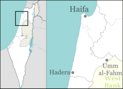
Kerem Maharal (Hebrew: כֶּרֶם מַהֲרַ"ל, lit. Maharal Vineyard) is a moshav in northern Israel. Located near Atlit, it falls under the jurisdiction of Hof HaCarmel Regional Council. In 2017 it had a population of 746.[1]
History
The moshav was established in 1949 by group of Jewish holocaust survivors, originally from Czechoslovakia, who immigrated to Israel with the help of the Aliya movement after World War II, and was named after legendary 16th century Rabbi Judah Loew ben Bezalel, also known by the Hebrew acronym "Maharal" (Moreinu HaRav Loew, translated as Our teacher, the Rabbi Loew). It was built on the site of the depopulated Palestinian villages of Ijzim and Khirbat Al-Manara,[2][3] which were captured by the Israel Defense Forces in Operation Shoter during the 1948 Arab–Israeli War.[4] The residents lived in the Arab stone houses until the 1960s and some of the original structures remain today.[4][5]
Notable residents
- Ami Ayalon, former head of Shin Bet
References
| Wikimedia Commons has media related to Kerem Maharal. |
- 1 2 "List of localities, in Alphabetical order" (PDF). Israel Central Bureau of Statistics. Retrieved August 26, 2018.
- ↑ Khalidi, Walid (1992). All That Remains: The Palestinian Villages Occupied and Depopulated by Israel in 1948. Washington D.C.: Institute for Palestine Studies. p. 165. ISBN 0-88728-224-5.
- ↑ Khalidi, 1992, p. 176
- 1 2 Ehud Ein-Gil (September 14, 2006). "It takes a village". Haaretz.
- ↑ Rochelle A. Davis (2011). Palestinian Village Histories. Stanford University Press. p. 162.