Kaya, Burkina Faso
| Kaya, Burkina Faso | |
|---|---|
| Regional capital | |
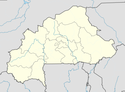 Kaya, Burkina Faso Location within Burkina Faso, French West Africa | |
| Coordinates: 13°05′00″N 01°05′00″W / 13.08333°N 1.08333°WCoordinates: 13°05′00″N 01°05′00″W / 13.08333°N 1.08333°W | |
| Country |
|
| Region | Centre-Nord |
| Province | Sanmatenga |
| Government | |
| • Mayor | Mahama Bélémviré[1] |
| Elevation | 353 m (1,158 ft) |
| Population (2012) | |
| • Total | 66,851 |
| Time zone | UTC+0 (GMT) |
Kaya is the seventh largest city in Burkina Faso, lying northeast of Ouagadougou, to which it is connected by railway. It is a centre for weaving and tanning.
Kaya is the capital of Sanmatenga Province. It is 100 kilometres (62 mi) from Ouagadougou, the capital of Burkina Faso.
Demographics
Kaya had 66,851 inhabitants (2012).
Population growth:
| Year | Inhabitants |
|---|---|
| 1985 (census) | 29.359 |
| 1996 (census) | 33.958 |
| 2006 (census) | 51,778 |
Infrastructure
Kaya Airport is a public airport in Kaya. As of 2014 it did not have any scheduled commercial flights.
In 1988 Kaya was connected by railway to Ouagadougou[2] but, as of 2014, there were no passenger services available.
Kaya is a road junction for the N3 and N15 national highways that link the city with Dori, Ouagadougou and Pouytenga, Boulsa, Kongoussi and Ouahigouya, respectively.
Education
- technical college for girls
- secondary school
Climate
Köppen-Geiger climate classification system classifies its climate as hot semi-arid (BSh).
| Climate data for Kaya | |||||||||||||
|---|---|---|---|---|---|---|---|---|---|---|---|---|---|
| Month | Jan | Feb | Mar | Apr | May | Jun | Jul | Aug | Sep | Oct | Nov | Dec | Year |
| Average high °C (°F) | 32 (90) |
35.3 (95.5) |
37.9 (100.2) |
39.1 (102.4) |
37.8 (100) |
35.1 (95.2) |
32.2 (90) |
30.8 (87.4) |
32.1 (89.8) |
36.1 (97) |
35.3 (95.5) |
32.5 (90.5) |
34.7 (94.5) |
| Daily mean °C (°F) | 24.3 (75.7) |
27.2 (81) |
30.3 (86.5) |
32.2 (90) |
31.4 (88.5) |
29 (84) |
27.1 (80.8) |
26.1 (79) |
26.9 (80.4) |
29.4 (84.9) |
27.6 (81.7) |
24.8 (76.6) |
28 (82.4) |
| Average low °C (°F) | 16.6 (61.9) |
19.2 (66.6) |
22.7 (72.9) |
25.3 (77.5) |
25 (77) |
23 (73) |
22 (72) |
21.4 (70.5) |
21.8 (71.2) |
22.8 (73) |
19.9 (67.8) |
17.2 (63) |
21.4 (70.5) |
| Average precipitation mm (inches) | 0 (0) |
0 (0) |
4 (0.16) |
13 (0.51) |
41 (1.61) |
98 (3.86) |
153 (6.02) |
207 (8.15) |
111 (4.37) |
21 (0.83) |
0 (0) |
0 (0) |
648 (25.51) |
| Source: Climate-Data.org, altitude: 331m[3] | |||||||||||||
Sister cities


See also
References
- ↑ In: Le Pays, 8 June 2006 Archived 28 September 2007 at the Wayback Machine.
- ↑ Historical Dictionary of Burkina Faso, by Lawrence Rupley, Lamissa Bangali, Boureima Diamitani, 2013, third edition, Scarecrow Press, Inc. ISBN 978-0-8108-6770-3
- ↑ "Climate: Kaya - Climate graph, Temperature graph, Climate table". Climate-Data.org. Retrieved 19 October 2013.