Katzir
| Katzir קָצִיר | |
|---|---|
 Katzir | |
| Coordinates: 32°29′17″N 35°06′07″E / 32.48806°N 35.10194°ECoordinates: 32°29′17″N 35°06′07″E / 32.48806°N 35.10194°E | |
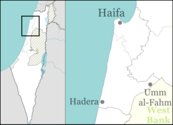
| District | Haifa |
| Council | Menashe |
| Founded | 1982 |
| Founded by | Hitahdut HaIkarim |
| Population (2017)[1] | 2,885 |
| Website | www.mykatzir.co.il |
Katzir (Hebrew: קָצִיר) is a Jewish locality in northern Israel. Located south-west of Umm al-Fahm and close to the Green Line, it falls under the jurisdiction of Menashe Regional Council. In 2017 it had a population of 2,885.[1]
History
The village was established in 1982 by Hitahdut HaIkarim on land owned by the Jewish Agency, and was initially a community settlement. In 1993 it was merged with neighbouring Harish to form Katzir-Harish local council. However, in 2012 the two were separated, with Harish remaining a local council and Katzir reverting to the jurisdiction of Menashe Regional Council.
References
- 1 2 "List of localities, in Alphabetical order" (PDF). Israel Central Bureau of Statistics. Retrieved August 26, 2018.
External links
This article is issued from
Wikipedia.
The text is licensed under Creative Commons - Attribution - Sharealike.
Additional terms may apply for the media files.