Kastl, Upper Bavaria
| Kastl | ||
|---|---|---|
 Village center | ||
| ||
 Kastl Location of Kastl within Altötting district 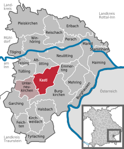 | ||
| Coordinates: 48°12′N 12°42′E / 48.200°N 12.700°ECoordinates: 48°12′N 12°42′E / 48.200°N 12.700°E | ||
| Country | Germany | |
| State | Bavaria | |
| Admin. region | Oberbayern | |
| District | Altötting | |
| Municipal assoc. | Unterneukirchen | |
| Government | ||
| • Mayor | Gottfried Mitterer (FW) | |
| Area | ||
| • Total | 27.36 km2 (10.56 sq mi) | |
| Elevation | 437 m (1,434 ft) | |
| Population (2017-12-31)[1] | ||
| • Total | 2,716 | |
| • Density | 99/km2 (260/sq mi) | |
| Time zone | CET/CEST (UTC+1/+2) | |
| Postal codes | 84556 | |
| Dialling codes | 08671 | |
| Vehicle registration | AÖ | |
| Website | www.kastl-obb.de | |

Kastl is a municipality in the district of Altötting in Bavaria in Germany. It is the result of a merger of Oberkastl, Unterkastl and Forstkastl in the 1960s.
References
- ↑ "Fortschreibung des Bevölkerungsstandes". Bayerisches Landesamt für Statistik und Datenverarbeitung (in German). September 2018.
Towns and municipalities in Altötting district | ||
|---|---|---|
This article is issued from
Wikipedia.
The text is licensed under Creative Commons - Attribution - Sharealike.
Additional terms may apply for the media files.