Cashan (Peru)
| Cashan | |
|---|---|
| Tijeraspunta | |
 | |
| Highest point | |
| Elevation | 5,716 m (18,753 ft) |
| Coordinates | 9°33′26″S 77°21′20″W / 9.55722°S 77.35556°WCoordinates: 9°33′26″S 77°21′20″W / 9.55722°S 77.35556°W |
| Geography | |
 Cashan Peru | |
| Location | Peru, Ancash Region |
| Parent range | Andes, Cordillera Blanca |
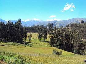
Cashan,[1][2][3][4] Kashan[3] (possibly from Quechua kasha thorn or spine[5] -n a suffix) or Tijeraspunta[6] is a mountain in the Cordillera Blanca in the Andes of Peru, about 5,716 metres (18,753 ft) high.[1][6] It is located in the Ancash Region, Huaraz Province, in the districts of Huaraz and Olleros. Cashan lies southeast of the town of Huaraz, southwest of Huantsán, west of Uruashraju and northeast of Shacsha.[1]
References
- 1 2 3 Alpenvereinskarte 0/3b. Cordillera Blanca Süd (Peru). 1:100 000. Oesterreichischer Alpenverein. 2005. ISBN 3-937530-05-3.
- ↑ Biggar, John (2005). The Andes: A Guide for Climbers. Andes. p. 85. ISBN 9780953608720.
- 1 2 Ricker, John (1977). Yuraq Janka: A Guide to the Peruvian Andes. The Mountaineers Books. p. 115. ISBN 9781933056708.
- ↑ Díaz, Felipe (2008–2009). Carta Turística. Cordilleras Blanca, Negra, Huayhuash y Callejón de Huaylas.
- ↑ Toponimos de Yunkay
- 1 2 Peru 1:100 000, Recuay (20-i). IGN (Instituto Geográfico Nacional - Perú).
This article is issued from
Wikipedia.
The text is licensed under Creative Commons - Attribution - Sharealike.
Additional terms may apply for the media files.