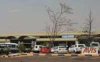
Kasane Airport
| Kasane International Airport | |||||||||||
|---|---|---|---|---|---|---|---|---|---|---|---|
 | |||||||||||
| Summary | |||||||||||
| Airport type | Public | ||||||||||
| Operator | Botswana Department of Civil Aviation | ||||||||||
| Serves | Kasane, Botswana | ||||||||||
| Elevation AMSL | 3,290 ft / 1,003 m | ||||||||||
| Coordinates | 17°49′55″S 25°09′50″E / 17.83194°S 25.16389°E | ||||||||||
| Map | |||||||||||
 BBK Location of the airport in Botswana | |||||||||||
| Runways | |||||||||||
| |||||||||||
Kasane International Airport (IATA: BBK, ICAO: FBKE) is an airport serving Kasane, a town in the North-West District of Botswana. The airport is along the A33 Road, 2 kilometres (1.2 mi) south of the town and 3 kilometres (1.9 mi) from the border with Namibia.
Air Botswana provides scheduled service between Kasane and Gaborone on Tuesdays, Fridays, and Sundays. Numerous charter flight operators offer flights to other destinations in the vicinity.
Because it is near Chobe National Park, the airport is mainly used for tourism. Most lodges in the Kasane area provide shuttles from and to the airport. A bus shuttle is available for travel to Victoria Falls in Zimbabwe.
Airlines and destinations
| Airlines | Destinations |
|---|---|
| Air Botswana | Gaborone, Johannesburg–OR Tambo, Maun |
| Airlink | Johannesburg–OR Tambo |
Charter operators
- Wilderness Air - Windhoek to Kasane.[3]
- Moremi Air Services
See also
References
- ↑ Airport information for Kasane Airport at Great Circle Mapper.
- ↑ Google Maps - Kasane
- ↑ "Wilderness Air » Botswana". www.wilderness-air.com. Retrieved 2018-08-20.
External links
- OpenStreetMap - Kasane
- OurAirports - Kasane
- SkyVector - Kasane
- Kasane Airport information
- Airport information for Kasane Airport at World Aero Data. Data current as of October 2006.
- Accident history for Kasane Airport at Aviation Safety Network
- Current weather for Kasane Airport at NOAA/NWS
This article is issued from
Wikipedia.
The text is licensed under Creative Commons - Attribution - Sharealike.
Additional terms may apply for the media files.