Karyes
| Karyes Καρυές | |
|---|---|
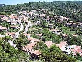 View of Karyes. | |
 Karyes Location within the regional unit 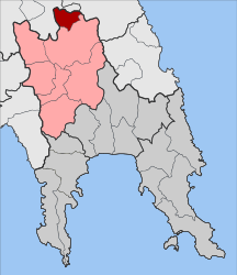 | |
| Coordinates: 37°17′N 22°30′E / 37.283°N 22.500°ECoordinates: 37°17′N 22°30′E / 37.283°N 22.500°E | |
| Country | Greece |
| Administrative region | Peloponnese |
| Regional unit | Laconia |
| Municipality | Sparti |
| • Municipal unit | 64.43 km2 (24.88 sq mi) |
| Population (2011)[1] | |
| • Municipal unit | 729 |
| • Municipal unit density | 11/km2 (29/sq mi) |
| Time zone | UTC+2 (EET) |
| • Summer (DST) | UTC+3 (EEST) |
| Vehicle registration | AK |
Karyes (Greek: Καρυές, before 1930: Αράχωβα - Arachova[2]) is a village and a former community in Laconia, Peloponnese, Greece. Since the 2011 local government reform it is part of the municipality Sparti, of which it is a municipal unit.[3] The municipal unit has an area of 64.426 km2.[4] It is located roughly midway between Tripoli and Sparti. Population 729 (2011).
History
Caryae or Karyai (Ancient Greek: Καρυαί) was a town in ancient Laconia, near the border with Arcadia. It was situated on the road from Tegea to Sparta.[5] Caryae had a sanctuary of Artemis, where the Lacedaemonian maidens held chorus dances.[6] The caryatids, sculpted female figures used in architecture, were probably named after these maidens from Caryae.[5] The modern village Karyes was named after this ancient town.
References
- ↑ "Απογραφή Πληθυσμού - Κατοικιών 2011. ΜΟΝΙΜΟΣ Πληθυσμός" (in Greek). Hellenic Statistical Authority.
- ↑ Name changes of settlements in Greece
- ↑ Kallikratis law Greece Ministry of Interior (in Greek)
- ↑ "Population & housing census 2001 (incl. area and average elevation)" (PDF) (in Greek). National Statistical Service of Greece. Archived from the original (PDF) on 2015-09-21.
- 1 2

- ↑ Pausanias, Description of Greece, 3.10.7
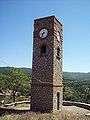 Clock tower (c.1900)
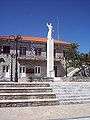 The central square.
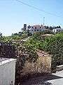 View of the village.
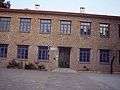 The school of the community.