Karlskrona Municipality
| Karlskrona Municipality Karlskrona kommun | ||
|---|---|---|
| Municipality | ||
 Karlskrona Town Hall | ||
| ||
 | ||
| Country | Sweden | |
| County | Blekinge County | |
| Seat | Karlskrona | |
| Area[1] | ||
| • Total | 3,338.05 km2 (1,288.83 sq mi) | |
| • Land | 1,042.21 km2 (402.40 sq mi) | |
| • Water | 2,295.84 km2 (886.43 sq mi) | |
| Area as of 1 January 2014. | ||
| Population (31 December 2017)[2] | ||
| • Total | 66,666 | |
| • Density | 20/km2 (52/sq mi) | |
| Time zone | UTC+1 (CET) | |
| • Summer (DST) | UTC+2 (CEST) | |
| ISO 3166 code | SE | |
| Province | Blekinge | |
| Municipal code | 1080 | |
| Website | www.karlskrona.se | |

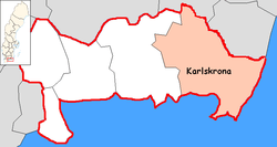
Karlskrona Municipality (Karlskrona kommun) is a municipality in Blekinge County in South Sweden in southern Sweden. It borders to Emmaboda Municipality, Torsås Municipality and Ronneby Municipality. The city of Karlskrona is the seat of the municipality.
Like most Swedish municipalities it was created during the municipal reform in the early seventies, combining several earlier local government units of urban and rural type, among them the City of Karlskrona.
Localities
There are 18 urban areas (also called a Tätort or locality) in Karlskrona Municipality.
In the table the localities are listed according to the size of the population as of December 31, 2005. The municipal seat is in bold characters.
| # | Locality | Population |
|---|---|---|
| 1 | Karlskrona | 32,606 |
| 2 | Rödeby | 3,356 |
| 3 | Nättraby | 3,053 |
| 4 | Jämjö | 2,596 |
| 5 | Hasslö | 1,643 |
| 6 | Sturkö | 1,293 |
| 7 | Fridlevstad | 697 |
| 8 | Tving | 477 |
| 9 | Torhamn | 473 |
| 10 | Spjutsbygd | 422 |
| 11 | Fågelmara | 398 |
| 12 | Skavkulla och Skillingenäs | 380 |
| 13 | Holmsjö | 347 |
| 14 | Drottningskär | 328 |
| 15 | Gängletorp | 276 |
| 16 | Kättilsmåla | 238 |
| 17 | Nävragöl | 229 |
| 18 | Brömsebro | 213 |
Parishes
Parishes ordered by city and hundreds:
- Karlskrona
- Karlskrona City Parish
- Royal Karlskrona Admiralty Parish
- Eastern Hundred
- Augerum Parish
- Flymen Parish
- Jämjö Parish
- Kristianopel Parish
- Lösen Parish
- Ramdala Parish
- Rödeby Parish
- Sturkö Parish
- Torhamn Parish
- Virserum Parish
- Medelstad Hundred
- Aspö Parish
- Fridlevstad Parish
- Hasslö Parish
- Nättraby Parish
- Sillhövda Parish
- Tving Parish
- Hästö
International relations
Twin towns - sister cities
The municipality is twinned with[3]
|
|
|
See also
- Swedish Coast Guard
- Blekinge Institute of Technology
- Swedish National Maritime Museums
References
- ↑ "Statistiska centralbyrån, Kommunarealer den 1 januari 2014" (Microsoft Excel) (in Swedish). Statistics Sweden. Retrieved 2014-04-18.
- ↑ "Folkmängd i riket, län och kommuner 31 december 2017" (in Swedish). Statistics Sweden. February 21, 2018. Retrieved February 21, 2018.
- ↑ http://www.karlskrona.se/sv/VisitKarlskrona/Info/Karlskronas-vanorter/
External links
- Karlskrona Municipality - Official site
- Mitt Karlskrona - Swedish Karlskrona city guide
- Coat of arms
Municipalities and seats of Blekinge County | ||
|---|---|---|
| Municipalities | ||
| Municipal seats | ||