Karlików
| Karlików | |
|---|---|
| Village | |
 Karlików | |
| Coordinates: 49°26′04″N 22°04′01″E / 49.4344779°N 22.0668983°ECoordinates: 49°26′04″N 22°04′01″E / 49.4344779°N 22.0668983°E | |
| Country | Poland |
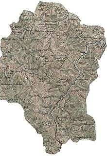
| Beskids | Subcarpathian Voivodship |
| Founded | 1483 |
| Area | |
| • Total | 8.8 km2 (3.4 sq mi) |
| Elevation | 290 m (950 ft) |
| Population | |
| • Total | 120 |
| Time zone | UTC+1 (CET) |
| • Summer (DST) | UTC+2 (CEST) |
| Postal code | 38507 |
Karlików (Ukrainian: Карликів, Karlykiv; Rusyn: Карликів, Karlykiv) is a village situated in the Subcarpathian Voivodship (province) of south-eastern Poland; previously in Krosno Voivodship (1975-1998) and Sanok district, (10 mi or 16 km east of Sanok). Karlików is about 10 mi (16 km) from Sanok. It is situated below the main watershed at the foot of the Słonne Mountain, and has an elevation of 340 m (1,115 ft).
Karlików– Karlykow 1483, Karlowa 1488, Karlikow 1557, Karlikow 1589, Karłykiw 1867, village in eastern Lesser Poland, in the Lesser Beskid mountains, Bukowsko rural commune.
History

Karlików was founded in 1483 by the Bals de Lobetanz family. From 966-1018, 1340-1772 (Ruthenian Voivodeship, Sanoker County) and from 1918-1939 Zboiska was part of Poland. From 1772 to 1918 it belonged to the Austrian empire. This part of Poland was controlled by Austria for almost 120 years. At that time the area (including west and east of Subcarpathian Voivodship) was known as Galicia. In 1785 the village lands comprised 61 łan.
Karlików is still a rural village inhabited mostly by ethnic Poles. It contains a ski slope which attracts seasonal tourism. The cemetery in Karlików still contains headstones of the Lemko families who once lived there.
See also
- Komańcza Republic (November 1918 – January 1919)
References and literature
- Prof. Adam Fastnacht. Slownik Historyczno-Geograficzny Ziemi Sanockiej w Średniowieczu (Historic-Geographic Dictionary of the Sanok District in the Middle Ages), Kraków, 2002, ISBN 83-88385-14-3.
