Karlesspitze
| Karlesspitze | |
|---|---|
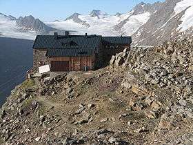 Ramolhaus in front of the Gurgler Ferner (glacier). Karlesspitze is the peak on the right. | |
| Highest point | |
| Elevation | 3,465 m (11,368 ft) |
| Prominence | 185 m (607 ft) |
| Isolation | 3.2 kilometres (2.0 mi) |
| Parent peak | Schalfkogel |
| Coordinates | 46°46′20″N 10°58′30″E / 46.77222°N 10.97500°ECoordinates: 46°46′20″N 10°58′30″E / 46.77222°N 10.97500°E |
| Geography | |
 Karlesspitze Location within Austria on the Austrian—Italian border | |
| Location | Tyrol, Austria / South Tyrol, Italy |
| Parent range | Ötztal Alps |
| Climbing | |
| First ascent | 1869 by A. Marshall, B. Grüner, P. Gstrein |
| Easiest route | Glacier tour |
The Karlesspitze or Grubspitze is a mountain in the Schnalskamm group of the Ötztal Alps on the border between Tyrol, Austria, and South Tyrol, Italy.
References
- Walter Klier: Alpenvereinsführer Ötztaler Alpen, Bergverlag Rudolf Rother, München 2006. ISBN 3-7633-1123-8
- Richard Goedeke: 3000er in den Nordalpen, Bruckmann, München 2004, ISBN 3-7654-3930-4
- Alpine Club Map, Scale 1:25.000, Sheet 30/1, Gurgl, ISBN 3-928777-38-6
- Casa Editrice Tabacco, Udine: Carta Topografica 1:25.000, Sheet 04, Schnalstal/Val Senales, Naturns/Naturno
This article is issued from
Wikipedia.
The text is licensed under Creative Commons - Attribution - Sharealike.
Additional terms may apply for the media files.