Kargasok
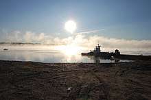
Sunrise over Ob River at the landing beach at Kargasok
Coordinates: 59°04′N 80°52′E / 59.067°N 80.867°E
Kargasok (Russian: Каргасок) is a rural locality (a selo) and the administrative center of Kargasoksky District of Tomsk Oblast, Russia, located on the left bank of the Ob River, 460 kilometers (290 mi) from Tomsk, the administrative center of the oblast. Population: 8,127 (2010 Census);[1] 8,547 (2002 Census);[2] 8,450 (1989 Census).[3]
Etymology
Its name means the bear cape in Selkup.
History
It was first mentioned in 1640. Originally, it was located on the left bank of the Panigadka River, but after the intense deforestation, the Panigadka became too shallow for large ships to approach, prompting Kargasok's move to its present location.
References
- ↑ Russian Federal State Statistics Service (2011). "Всероссийская перепись населения 2010 года. Том 1" [2010 All-Russian Population Census, vol. 1]. Всероссийская перепись населения 2010 года (2010 All-Russia Population Census) (in Russian). Federal State Statistics Service. Retrieved June 29, 2012.
- ↑ Russian Federal State Statistics Service (May 21, 2004). "Численность населения России, субъектов Российской Федерации в составе федеральных округов, районов, городских поселений, сельских населённых пунктов – районных центров и сельских населённых пунктов с населением 3 тысячи и более человек" [Population of Russia, Its Federal Districts, Federal Subjects, Districts, Urban Localities, Rural Localities—Administrative Centers, and Rural Localities with Population of Over 3,000] (XLS). Всероссийская перепись населения 2002 года [All-Russia Population Census of 2002] (in Russian). Retrieved August 9, 2014.
- ↑ Demoscope Weekly (1989). "Всесоюзная перепись населения 1989 г. Численность наличного населения союзных и автономных республик, автономных областей и округов, краёв, областей, районов, городских поселений и сёл-райцентров" [All Union Population Census of 1989: Present Population of Union and Autonomous Republics, Autonomous Oblasts and Okrugs, Krais, Oblasts, Districts, Urban Settlements, and Villages Serving as District Administrative Centers]. Всесоюзная перепись населения 1989 года [All-Union Population Census of 1989] (in Russian). Институт демографии Национального исследовательского университета: Высшая школа экономики [Institute of Demography at the National Research University: Higher School of Economics]. Retrieved August 9, 2014.
This article is issued from
Wikipedia.
The text is licensed under Creative Commons - Attribution - Sharealike.
Additional terms may apply for the media files.