Karłów
| Karłów | |
|---|---|
| Village | |
 | |
 Karłów | |
| Coordinates: 50°28′N 16°20′E / 50.467°N 16.333°E | |
| Country |
|
| Voivodeship | Lower Silesian |
| County | Kłodzko |
| Gmina | Radków |
| Elevation | 750 m (2,460 ft) |
| Website | http://karlow.pl |
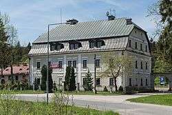
Karłów [ˈkarwuf] (German: Karlsberg) is a village in the administrative district of Gmina Radków, within Kłodzko County, Lower Silesian Voivodeship, in south-western Poland.[1]
It lies approximately 7 kilometres (4 mi) south-west of Radków, 23 km (14 mi) west of Kłodzko, and 89 km (55 mi) south-west of the regional capital Wrocław.
References
| Town and seat |  | |
|---|---|---|
| Villages | ||
Coordinates: 50°28′N 16°20′E / 50.467°N 16.333°E
This article is issued from
Wikipedia.
The text is licensed under Creative Commons - Attribution - Sharealike.
Additional terms may apply for the media files.