Kankrala
| Kankrala Fort | |
|---|---|
| Nashik district, Maharashtra | |
 Kankrala fort | |
 Kankrala Fort | |
| Coordinates | 20°42′24″N 74°29′11.8″E / 20.70667°N 74.486611°E |
| Type | hill fort |
| Height | 2476 feet |
| Site information | |
| Owner | Government of India |
| Open to the public | Yes |
| Condition | Ruins |
| Site history | |
| Materials | Stone |
| Medium | |
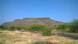
Kankrala is an ancient hill fort that occupies two hills in the Malegaon taluka of Nashik district.[1]
History
This fort is situated south of Galna fort. Very little history is known about this fort. It was captured by the British under Colonel Wallace in 1818.
Places to see
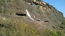
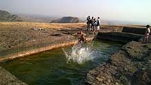
There are many rock cut water cisterns on the top of the fort as well as in the rocks near the gate. The water near the gate is potable. There are few caves near the entrance. The entrance is in dilapidated condition.There are no structures on the fort except few ruins.
How to reach
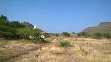
The village Karanjgavhan is situated near the village Kankrala.There is a direct road from Malegaon via Vadgaon and Lendhane villages to Karanjgavhan ( distance 11 km). The other route is through the road from Zodage which is on NH-3. Zodage to Karanjgavhan distance is about 15 km.From Karanjgavhan the road to the village Kankrala is abouut 5 km. The cart road take a western detour from village Kankrala which leads to the temple near the fort. From the temple the fort is clearly visible. It takes about an hour to reach the fort top. There are no proper steps or path ways.[2]
References
- ↑ Kankrala Fort
- ↑ Zingaro, Young (1995). Sangati sahyadricha. Sahyadri Prakashan. p. 278.