Kandankary
| Kandankary | |
|---|---|
 | |
 Kandankary | |
| Coordinates: 9°25′30″N 76°27′50″E / 9.42500°N 76.46389°ECoordinates: 9°25′30″N 76°27′50″E / 9.42500°N 76.46389°E | |
| Country |
|
| State | Kerala |
| District | Alappuzha |
| Talukas | Kuttanad |
| Languages | |
| • Official | Malayalam, English |
| Time zone | UTC+5:30 (IST) |
| PIN | 689573 |
| Telephone code | 0477 |
| Vehicle registration | KL-66, KL-04 |
| Nearest city | Alappuzha/Aleppey,Changanassery,Thiruvalla |
| Literacy | 97.64%. |
Kandankary is a small village in Kerala, India.[1] It is located in Champakulam Panchayat in Kuttanadu Taluk. It is presumed that this region (most part of Kuttanad) was a very big forest in ancient years, but later destroyed by a forest fire. It is still possible to see "kari" (coal) if we dig deep into the soil. So this place name end-up with Kari.
This village is famous for its ancient temple Kandakarykkavu Devi Temple & St. Joseph's Church Kandamkary & DVHSS Kandankary
Geography
Kandankary is located 14 km from Changanacherry,
22 km from Alappuzha & 27 km from Kottayam
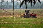
Economy
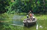
The major income is still from Agriculture and fishing despite tourism.
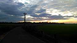
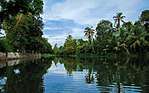
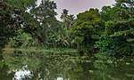
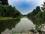
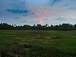
Gallery
References
- ↑ University of Kerala (1978). Journal of Kerala Studies. University of Kerala. p. 145. Retrieved 29 September 2018.
}
This article is issued from
Wikipedia.
The text is licensed under Creative Commons - Attribution - Sharealike.
Additional terms may apply for the media files.