Kampalapura
Tobacco Board
Kampalapura is a village in Mysore district of Karnataka state in India.
Location
Kampalapua is located between Mysuru and Madikeri cities at a latitude 12.335401 and longitude 76.158353. It is also called as Kamplapura. [1] Coordinates: 12°20′07″N 76°09′30″E / 12.335401°N 76.158353°E
Villages and suburbs
Periyapatna. 7 km Kushalnagar 28 km Bettadapura 22 km Ramanathapura 40 km Saligrama 38.5 km Hunasuru 16 km Gonikoppa 34 km Virajpete 50 km [2]
Demographics
The population of Kampalapura village is 4,721. There are a total of 1,112 families here.[3]
Economy
The economy of the village is mostly agrarian. The major crops are Tobacco, Ragi, Maize, Arecanut and Paddy grow here.
Educational organisations
- Govt Primary School, Kamplapura.
- Govt Urdu Primary School, Kamplapura.
- Govt High School, Kamplapura.
Post office
There is a post office in the village and the pincode is 571107.[4]
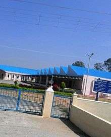
Image gallery
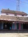 Old building in Kampalapura
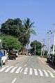 Kampalapura village
References
- ↑ https://www.google.co.in/maps/place/12%C2%B020'09.6%22N+76%C2%B009'33.3%22E/@12.335998,76.1570633,17z/data=!3m1!4b1!4m5!3m4!1s0x0:0x0!8m2!3d12.335998!4d76.159252
- ↑ http://wikiedit.org/India/Kampalapura/222680/
- ↑ http://www.census2011.co.in/data/village/618235-kampalapura-karnataka.html
- ↑ http://www.onefivenine.com/india/villages/Mysore/Piriyapatna/Kampalapura
This article is issued from
Wikipedia.
The text is licensed under Creative Commons - Attribution - Sharealike.
Additional terms may apply for the media files.