Kamalpur, Tripura
| Kamalpur, India কমলপুর | |
|---|---|
| city | |
 Kamalpur, India Location in Tripura, India  Kamalpur, India Kamalpur, India (India) | |
| Coordinates: 24°12′N 91°50′E / 24.2°N 91.83°ECoordinates: 24°12′N 91°50′E / 24.2°N 91.83°E | |
| Country |
|
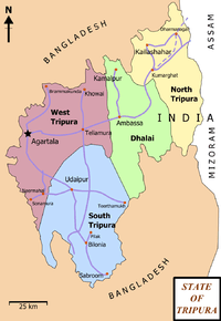
| State | Tripura |
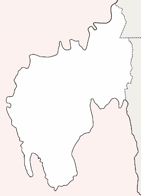
| District | Dhalai |
| Elevation | 16 m (52 ft) |
| Population (2011) | |
| • Total | 10,872 |
| Languages | |
| • Official | Bengali, Kokborok, English |
| Time zone | UTC+5:30 (IST) |
| Vehicle registration | TR |
| Website |
tripura |
Kamalpur is a town and a nagar panchayat in Dhalai district in the Indian state of Tripura. Around 93 km from the state capital Agartala. Kamalpur is the largest Sub-divisional town in Dhalai District .
Geography
Present on the bank of river Dhalai.It is mainly between two hills:Atharamura Range and longtorai Range.Kamalpur is located at 24°12′N 91°50′E / 24.2°N 91.83°E.[1] It has an average elevation of 16 metres (52 feet).
Climate
This place has a Tropical climate with hot and humid summers, a prolonged rainy season and warm winters. Rains are frequent in March and April. Maximum temperatures in summers and winters are 36 degree and 28 degree Celsius respectively. The minimum temperatures in summers and winters are 17 degree and 5.3 degree Celsius respectively.
Demographics
As of 2011 India census,[2] Kamalpur had a population of 10,872 of which 5,479 are males while 5,393 are females as per report released by Census India 2011. Population of Children with age of 0-6 is 988 which is 9.09% of total population of Kamalpur (NP). In Kamalpur Nagar Panchayat, Female Sex Ratio is of 984 against state average of 960. Moreover Child Sex Ratio in Kamalpur is around 900 compared to Tripura state average of 957. Kamalpur has an average literacy rate of 97.77 higher than the national average of 87.22% In Kamalpur, Male literacy is around 98.61% while female literacy rate is 96.93%.
Politics
Kamalpur assembly constituency is part of Tripura East (Lok Sabha constituency).[3] In Tripura assembly election it is part of Kamalpur (45) constituency.Kamalpur Nagar Panchayat constitutes 11 wards .
Education
There is only one college named Kamalpur Govt Degree College . There are many higher secondary, high schools, anganwadi centres present in this town .
Economy
Mainly agriculture based with several micro- and small-scale industrial units. There is one tea garden named Ramdurlabpur Tea Estate . Rubber plantation scattered in various areas . Major Market area is Kamalpur town and other small market places are in Fulchari, College chowmuhani, Kalachari and Manikbhandar.
Health care system
Only one hospital named BSM Hospital .
Transport
Road connectivity is present with Ambassa , Agartala , Khowai, Kumarghat .Nearest railway station is Ambassa railway station .Kamalpur Airport which serves Kamalpur is currently non-operational.[4]
Recreation, Media & Culture
Amar Tripura TV Channel (Bengali) is the only local tv channel . There is one town hall. Book fair occurs every year. The main festival of the town is Durga pujo being held every year by several clubs and songho. Others are Dipaboli, Charak Mela etc . Kamleshwari Kali Mandir situated at the heart of the town is the biggest temple . There are several ashram such as Ramkrishna and Ramthakur Saba songho .
See also
References
- ↑ Falling Rain Genomics, Inc - Kamalpur
- ↑ "Census of India 2001: Data from the 2001 Census, including cities, villages and towns (Provisional)". Census Commission of India. Archived from the original on 2004-06-16. Retrieved 2008-11-01.
- ↑ "Assembly Constituencies - Corresponding Districts and Parliamentary Constituencies" (PDF). Tripura. Election Commission of India. Archived from the original (PDF) on 2005-11-08. Retrieved 2008-10-08.
- ↑ "Unused Airports in India". Center For Asia Pacific Aviation. 27 November 2009. Retrieved 9 February 2012.