Kalilangan, Bukidnon
| Kalilangan | |||
|---|---|---|---|
| Municipality | |||
| Municipality of Kalilangan | |||
| |||
| Nickname(s): Gateway to Lanao, Gateway to Bangsamoro | |||
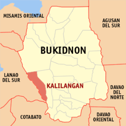 Map of Bukidnon with Kalilangan highlighted | |||
.svg.png) Kalilangan Location within the Philippines | |||
| Coordinates: 7°45′N 124°45′E / 7.75°N 124.75°ECoordinates: 7°45′N 124°45′E / 7.75°N 124.75°E | |||
| Country |
| ||
| Region | Northern Mindanao (Region X) | ||
| Province | Bukidnon | ||
| District | 4th District | ||
| Founded | January 1, 1968 | ||
| Barangays | 14 (see Barangays) | ||
| Government [1] | |||
| • Type | Sangguniang Bayan | ||
| • Mayor | Omaradji C. Pizarro | ||
| • Electorate | 21,918 voters (2016) | ||
| Area [2] | |||
| • Total | 251.43 km2 (97.08 sq mi) | ||
| Population (2015 census)[3] | |||
| • Total | 41,601 | ||
| • Density | 170/km2 (430/sq mi) | ||
| Time zone | UTC+8 (PST) | ||
| ZIP code | 8718 | ||
| PSGC | 101307000 | ||
| IDD : area code | +63 (0)88 | ||
| Climate type | Tropical rainforest climate | ||
| Income class | 2nd municipal income class | ||
| Revenue (₱) | 123,055,439.57 (2016) | ||
| Native languages |
Binukid Cebuano Ata Manobo Iranun Tagalog | ||
| Website |
www | ||


Kalilangan, officially the Municipality of Kalilangan, is a 2nd class municipality in the province of Bukidnon, Philippines. According to the 2015 census, it has a population of 41,601 people.[3]
Etymology
The term kalilangan came from a Maranao native tongue which means "extreme happiness". It used to be a barrio of Pangantucan, Bukidnon. Due to tremendous influx of settlers coming from the different parts of the country, it becomes an independent municipality.
History
In 1951 Kalilangan become one of the settlement areas under the LASEDECO (Land Settlement and Development Corporation). Christian settlers came and settled in this place. When LASEDECO was dissolved, it was replaced immediately by National Resettlement Rehabilitation Administration (NARRA) during the time of then President Ramon Magsaysay. Another batch of settlers came composed of different tribes and other ethnic groups in the country. They were Cebuanos, Waray, Boholanos, Bicolanos, Tagalogs, Ivatans, Ilonggos, Ilocanos, Capangpangan and other tribes in the island of Mindanao. Settlers were given aid by the government particularly working animals, subsistence, farm tools and others. As years rolled on land cultivation progressed and the settlers started planting different kinds of crops. Roads were opened and commerce flowed freely to the new barrio of Kalilangan. Other settlers also started engaging in business
In view of the fact that Kalilangan was considered as one of the most progressive barrios in the municipality of Pangantucan and by virtue of Republic Act No. 4788 approved on June 18, 1966, a bill was sponsored by ex-Congressman Benjamin N. Tabios, creating Kalilangan into a 6th class municipality and was organized and implemented on January 1, 1968, just after the 1967 elections.
Geography
The Municipality of Kalilangan is bounded on the north by the Municipality of Talakag, on the east and south by the Municipality of Pangantucan and on the west by the Province of Lanao del Sur. It has a land area of 28,414.10 hectares. The municipalities of Talakag and Pangantucan are claiming some parts of the municipality. Talakag claims 2,427.50 hectares of land in the northern portion of the municipality while Pangantucan is also contesting for 691.0 hectares of Kalilangan’s land area.
Topography
Kalilangan is characterized by rugged terrain with a limited plain or level area situated on the Poblacion and portion of the municipality. From its total land area, a dominant 76.57 percent are within 8-15 percent slope characterized by moderately undulating and gently rolling land. The barangays of San Vicente Ferrer and Ninoy Aquino are dominantly within this slope type.
Areas with 18 percent slope and above cover 15.61 percent. These are very steepy sloping and rolling land in many directions. The barangays of Macaopao, Lampanusan, portions of Kibaning, Public and Pamotolon are dominantly within the slope type.
The remaining 7.82 percent of the municipality level to nearly level land and gently sloping areas in one general direction within 0-3 percent, 3-5 percent and 5-15 percent slopes. These are common in the Poblacion portion of the municipality.
Barangays
Kalilangan is politically subdivided into 14 barangays.
| PSGC | Barangay | Population | ±% p.a. | |||
|---|---|---|---|---|---|---|
| 2015[3] | 2010[4] | |||||
| 101307001 | Bangbang | 3.3% | 1,365 | 1,227 | 2.05% | |
| 101307002 | Baborawon | 2.7% | 1,128 | 1,033 | 1.69% | |
| 101307003 | Canituan | 3.1% | 1,289 | 1,354 | −0.93% | |
| 101307004 | Kibaning | 2.3% | 941 | 849 | 1.98% | |
| 101307005 | Kinura | 5.8% | 2,398 | 2,060 | 2.94% | |
| 101307006 | Lampanusan | 7.6% | 3,181 | 3,120 | 0.37% | |
| 101307007 | Maca‑opao | 7.2% | 2,996 | 2,897 | 0.64% | |
| 101307008 | Malinao | 13.8% | 5,728 | 6,038 | −1.00% | |
| 101307009 | Pamotolon (Pamotdon) | 3.8% | 1,579 | 1,256 | 4.45% | |
| 101307010 | Poblacion | 17.5% | 7,284 | 6,874 | 1.11% | |
| 101307012 | Public | 5.6% | 2,338 | 2,058 | 2.46% | |
| 101307013 | Ninoy Aquino | 9.4% | 3,908 | 3,279 | 3.40% | |
| 101307014 | San Vicente Ferrer | 7.2% | 3,007 | 3,535 | −3.03% | |
| 101307015 | West Poblacion | 10.7% | 4,459 | 4,267 | 0.84% | |
| Total | 41,601 | 39,847 | 0.82% | |||
Demographics
| Population census of Kalilangan | ||
|---|---|---|
| Year | Pop. | ±% p.a. |
| 1970 | 12,325 | — |
| 1975 | 16,893 | +6.53% |
| 1980 | 18,316 | +1.63% |
| 1990 | 23,923 | +2.71% |
| 1995 | 26,973 | +2.27% |
| 2000 | 30,592 | +2.74% |
| 2007 | 36,557 | +2.49% |
| 2010 | 39,847 | +3.19% |
| 2015 | 41,601 | +0.82% |
| Source: Philippine Statistics Authority[3][4][5][6] | ||
In the 2015 census, the population of Kalilangan was 41,601 people,[3] with a density of 170 inhabitants per square kilometre or 440 inhabitants per square mile.
Historical growth
It was on 1970 that the Municipality of Kalilangan first attempted to conduct a census in its area of jurisdiction. On that year a total of 12,326 inhabitants have been registered by the Philippine Statistics Authority (NSO). Five years later NSO conducted another Census of Population registering 15,389 inhabitants revealing that for 5 years time 1970-1975 the municipality has reached a population increase of 24.85%. On the next 5 years from 1975-1980 NSO recorded 19.01% of inhabitants as has been added to the population of the municipality, revealing therefore that a population growth rate drop of 5.84% compared to that of 1970-1975 had happened.
After 10 years the next population census had been conducted by NSO registering a population of 23,923 inhabitants on 1990. In comparison with the municipality’s census two decades ago, from 1970–1980 and from 1980-1990 a population increase of 48.58% and 30.62% respectively was observed. In terms of population growth rate (1970-1980 has 4.04% and 1980-1990 2.70%)
Important population data also came up for population trend analysis was the 1990-1995 population census revealing a population increase of 12.75% with a population growth rate of 2.43%
Another population increase was recorded when official result of May 1, 2000 census of population was published. It recorded a total of 30, 592 persons for the municipality with 5,873 households, an average household size of 5 persons and recorded an average of 2.74 birth rate and death rate of 0.24.
The 2007 Census shows an increase in the population to 36,557.
Language
Presently Kalilangan was inhabited by about 47 different tribes with different languages on which 36% were Binukid, 24% Cebuano, 20% Maranao, 6% Hiligaynon/Ilonggo, 6% Ivatan/Itbayat and 5% Boholano. Binukid the dominant language in the municipality.
Religion
In terms of denomination, Kalilangan has about 21 known numbers of religious affiliation on which prevailing dominant group is the Roman Catholic of about 46.9%, followed by Islam which is equivalent to 37.22%. Other group of Baptist of 2.88%, Assembly of God 2.23%, Iglesia ni Cristo of 2.02%, and the remaining 9.25% belongs to the remaining sixteen (16) other denominations.
References
- ↑ "Municipality". Quezon City, Philippines: Department of the Interior and Local Government. Retrieved 31 May 2013.
- ↑ "Province: Bukidnon". PSGC Interactive. Quezon City, Philippines: Philippine Statistics Authority. Retrieved 12 November 2016.
- 1 2 3 4 5 Census of Population (2015). "Region X (Northern Mindanao)". Total Population by Province, City, Municipality and Barangay. PSA. Retrieved 20 June 2016.
- 1 2 Census of Population and Housing (2010). "Region X (Northern Mindanao)". Total Population by Province, City, Municipality and Barangay. NSO. Retrieved 29 June 2016.
- ↑ Censuses of Population (1903–2007). "Region X (Northern Mindanao)". Table 1. Population Enumerated in Various Censuses by Province/Highly Urbanized City: 1903 to 2007. NSO.
- ↑ "Province of Bukidnon". Municipality Population Data. Local Water Utilities Administration Research Division. Retrieved 17 December 2016.
External links
Places adjacent to Kalilangan, Bukidnon | |
|---|---|