Kalabaydh, Sool
| Kalabaydh | |
|---|---|
| Town | |
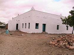 Masjidka Kalabaydh | |
 Kalabaydh Location in Somalia | |
| Coordinates: 8°14′29″N 47°13′34″E / 8.24139°N 47.22611°ECoordinates: 8°14′29″N 47°13′34″E / 8.24139°N 47.22611°E | |
| Country |
|
| Region | Sool |
| District | Kalabaydh District |
| Population (2018) | |
| • Total | 80,000 |
| Time zone | UTC+3 (EAT) |
Kalabaydh, also spelled Kalabayr, is a District in the Southern Sool region of Somalia.[1]
Overview
Kalabaydh District have a population of 80,000 resident it covers all of Southern Sool region.it is the largest District in Sool region by land mass and it is considered to have abundant water wells.Kalabaydh district have numerous Towns and villages including Saaxdheer, XidhXidh, Karin Dabayl Weyn, Qoriley, Dhumay, Dabataag, Dharkayn Geenyo, Tuurgasangas, Salaxa, Qudhaq Maqshin, Geelboob. The city is located near Las Anod, Southern Sool region not to be confused with the other Kalabaydh situated between Tog Wajaale and Hargeisa. Its name Kalabaydh (meaning "crossroads") is derived from the town's location at the juncture of these settlements.
It is settled by the Bahararsame Subclan of Dhulbahante, Darod clan. Local control is disputed between Somaliland, Puntland and Khatumo State (formerly HBM-SSC or Hoggaanka Badbaadada iyo Mideynta SSC[2]).
Education
Kalabaydh has a number of academic institutions. According to the Puntland Ministry of Education, there are 8 primary schools in the Kalabaydh District. Among these are Kalabayr Primary, Saaxdheer, Xidh-Xidh and Qorilay.[3] Secondary schools in the area include Kalabayr Secondary.[4]
Notes
- ↑ "Districts of Somalia".
- ↑ Somaliland’s Quest for International Recognition and the HBM-SSC Factor Archived 2012-05-28 at the Wayback Machine.
- ↑ "Puntland - Primary schools". Ministry of Education of Puntland. Retrieved 26 May 2013.
- ↑ "Puntland - Secondary schools". Ministry of Education of Puntland. Retrieved 26 May 2013.