Kakshaal Too
| Kakshaal Too | |
|---|---|
| Кокшаал Тоо | |
 | |
| Highest point | |
| Peak | Jengish Chokusu |
| Elevation | 7,439 m (24,406 ft) |
| Coordinates | 41°40′12″N 79°00′00″E / 41.67000°N 79.00000°ECoordinates: 41°40′12″N 79°00′00″E / 41.67000°N 79.00000°E |
| Dimensions | |
| Length | 582 km (362 mi) E-W |
| Width | 54 km (34 mi) N-S |
| Naming | |
| Etymology | in Kyrgyz "Какшаал" meaning wild, severe, and "Тоо" - mountains |
| Native name | Какшаал Тоо |
| Geography | |
 Kakshaal Too | |
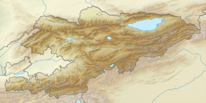
| Countries | Kyrgyzstan and China |
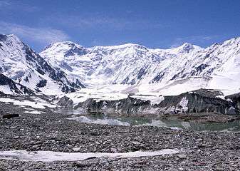
The Kakshaal Too (Kyrgyz: Какшаал Тоо, Qaqşaal Too, قاقشاال توو) is a large mountain range in the Central Tien-Shan. It stretches for a length of 582 km (in Kyrgyzstan) between Kyrgyzstan and China. The highest point in the range is Jengish Chokusu (7,439 metres (24,406 ft)). The range is mainly composed of limestones, siltstones, sandstones, conglomerates, and argillites of Paleozoic intruded by granites, granosyenite, and syenite.[1]
References
This article is issued from
Wikipedia.
The text is licensed under Creative Commons - Attribution - Sharealike.
Additional terms may apply for the media files.