Kadriye
| Kadriye | |
|---|---|
| Village | |
| map | |
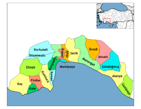 Location of Kadriye within Turkey. | |
| Coordinates: 36°51′N 31°03′E / 36.850°N 31.050°ECoordinates: 36°51′N 31°03′E / 36.850°N 31.050°E | |
| Country |
|
| Region | Mediterranean |
| Province | Antalya |
| District | Serik |
| Time zone | UTC+2 (EET) |
| • Summer (DST) | UTC+3 (EEST) |
| Postal code | 075xx |
| Area code(s) | (0090)+ 242 725 xx xx |
| Vehicle registration | 07 |
| Website |
www |
Kadriye is a village in the District of Serik, Antalya Province, Turkey. [1]
Kadriye is the first place to have a golf course in Turkey.
History
Municipality since 1994
Geography
Kadriye; distance to Serik 15 km, Distance to Antalya 30 km
References
- ↑ "Population of city, towns and villages – 2010". Turkish Statistical Institute. Archived from the original on 2 May 2012. Retrieved 22 July 2012.
External links
This article is issued from
Wikipedia.
The text is licensed under Creative Commons - Attribution - Sharealike.
Additional terms may apply for the media files.