Kadisha River
| Kadisha River | |
|---|---|
 The river at its upper reaches | |
| Country | Lebanon |
| Physical characteristics | |
| Main source | Qurnat as Sawda', Lebanon |
| River mouth |
Mediterranean Sea 34°27′28″N 35°50′29″E / 34.4579°N 35.8415°ECoordinates: 34°27′28″N 35°50′29″E / 34.4579°N 35.8415°E |
| Length | 45 kilometres (28 mi) |
The Kadisha River or Nahr Abu Ali is a river in Lebanon. It runs 45 kilometres (28 mi) east to west from the Kadisha grotto, halfway between Bsharri and the Cedars of God, to the Mediterranean Sea at Tripoli. The river runs along the Kadisha Valley, carving out deep gorges.
On its passage through Tripoli, it is walled and partially covered. The river is very polluted.[1]
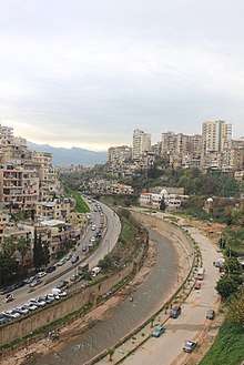
The walled Nahr Abu Ali at Tripoli
References
This article is issued from
Wikipedia.
The text is licensed under Creative Commons - Attribution - Sharealike.
Additional terms may apply for the media files.