Kadar, Russia
| Kadar Кадар (Russian) | |
|---|---|
| - Rural locality - | |
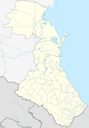
.svg.png) Location of the Republic of Dagestan in Russia | |
 Kadar | |
| Administrative status | |
| Country | Russia |
| Federal subject | Dagestan |
| Administrative district | Buynaksky District |
| Statistics | |
| Population (2016 est.) | 2,612 inhabitants[1] |
| Time zone | MSK (UTC+03:00)[2] |
Kadar (Russian: Кадар) is a rural locality in the Buynaksky District of the Republic of Dagestan in Russia. It was one of four villages under the control of the Islamic Djamaat of Dagestan between 1998 and 1999.
Geography
Kadar is located 28 km southeast of the regional capital of Buynaksk, in the southeastern part of the Buynaksky District. Its highest point is 1,536 meters above sea level. Kadar is bordered to the west by the rural locality of Karamakhi, to the north by Chankurbe and Vanashimahi, in the northeast by Kachkalykom, and in the south and southeast by the Chonkatau Ridge.
References
- ↑ "Численность населения Российской Федерации по муниципальным образованиям на 1 января 2016 года" (in Russian). (RAR file)
- ↑ Правительство Российской Федерации. Федеральный закон №107-ФЗ от 3 июня 2011 г. «Об исчислении времени», в ред. Федерального закона №271-ФЗ от 03 июля 2016 г. «О внесении изменений в Федеральный закон "Об исчислении времени"». Вступил в силу по истечении шестидесяти дней после дня официального опубликования (6 августа 2011 г.). Опубликован: "Российская газета", №120, 6 июня 2011 г. (Government of the Russian Federation. Federal Law #107-FZ of June 31, 2011 On Calculating Time, as amended by the Federal Law #271-FZ of July 03, 2016 On Amending Federal Law "On Calculating Time". Effective as of after sixty days following the day of the official publication.).
This article is issued from
Wikipedia.
The text is licensed under Creative Commons - Attribution - Sharealike.
Additional terms may apply for the media files.