Kaa-Khemsky District
| Kaa-Khemsky District Каа-Хемский кожуун (Russian) Каа-Хем кожуун (Tuvan) | |
|---|---|
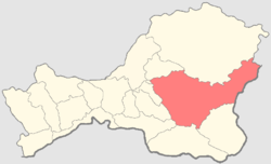 Location of Kaa-Khemsky District in the Tuva Republic | |
| Coordinates: 51°16′08″N 96°33′14″E / 51.269°N 96.554°ECoordinates: 51°16′08″N 96°33′14″E / 51.269°N 96.554°E | |
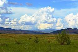 Landscape in Kaa-Khemsky District | |
| Location | |
| Country | Russia |
| Federal subject | Tuva Republic[1] |
| Administrative structure (as of November 2007) | |
| Administrative center | selo of Saryg-Sep[1] |
| Administrative divisions:[1] | |
| sumon | 11 |
| Inhabited localities:[1] | |
| Rural localities | 16 |
| Municipal structure (as of October 2011) | |
| Municipally incorporated as | Kaa-Khemsky Municipal District[2] |
| Municipal divisions:[2] | |
| Urban settlements | 0 |
| Rural settlements | 11 |
| Statistics | |
| Area (municipal district) (October 2011) | 25,726.04 km2 (9,932.88 sq mi)[2] |
| Population (2010 Census) | 12,279 inhabitants[3] |
| • Urban | 0% |
| • Rural | 100% |
| Density | 0.48/km2 (1.2/sq mi)[4] |
| Time zone | KRAT (UTC+07:00)[5] |
| Official website | |
| Kaa-Khemsky District on WikiCommons | |
Kaa-Khemsky District (Russian: Каа́-Хе́мский кожуун; Tuvan: Каа-Хем кожуун) (also, Kaa-Khemskiy) is an administrative[1] and municipal[2] district (raion, or kozhuun), one of the seventeen in the Tuva Republic, Russia. It is located in the center and east of the republic. The area of the district is 25,726.04 square kilometers (9,932.88 sq mi).[2] Its administrative center is the rural locality (a selo) of Saryg-Sep.[1] Population: 12,279 (2010 Census);[3] 13,071 (2002 Census);[6] 14,982 (1989 Census).[7] The population of Saryg-Sep accounts for 36.0% of the district's total population.[3]
References
Notes
- 1 2 3 4 5 6 Resolution #1648 ZP-1
- 1 2 3 4 5 Law #268 VKh-1
- 1 2 3 Russian Federal State Statistics Service (2011). "Всероссийская перепись населения 2010 года. Том 1" [2010 All-Russian Population Census, vol. 1]. Всероссийская перепись населения 2010 года (2010 All-Russia Population Census) (in Russian). Federal State Statistics Service. Retrieved June 29, 2012.
- ↑ The value of density was calculated automatically by dividing the 2010 Census population by the area specified in the infobox. Please note that this value is only approximate as the area specified in the infobox does not necessarily correspond to the area of the entity proper or is reported for the same year as the population.
- ↑ Правительство Российской Федерации. Федеральный закон №107-ФЗ от 3 июня 2011 г. «Об исчислении времени», в ред. Федерального закона №271-ФЗ от 03 июля 2016 г. «О внесении изменений в Федеральный закон "Об исчислении времени"». Вступил в силу по истечении шестидесяти дней после дня официального опубликования (6 августа 2011 г.). Опубликован: "Российская газета", №120, 6 июня 2011 г. (Government of the Russian Federation. Federal Law #107-FZ of June 31, 2011 On Calculating Time, as amended by the Federal Law #271-FZ of July 03, 2016 On Amending Federal Law "On Calculating Time". Effective as of after sixty days following the day of the official publication.).
- ↑ Russian Federal State Statistics Service (May 21, 2004). "Численность населения России, субъектов Российской Федерации в составе федеральных округов, районов, городских поселений, сельских населённых пунктов – районных центров и сельских населённых пунктов с населением 3 тысячи и более человек" [Population of Russia, Its Federal Districts, Federal Subjects, Districts, Urban Localities, Rural Localities—Administrative Centers, and Rural Localities with Population of Over 3,000] (XLS). Всероссийская перепись населения 2002 года [All-Russia Population Census of 2002] (in Russian). Retrieved August 9, 2014.
- ↑ Demoscope Weekly (1989). "Всесоюзная перепись населения 1989 г. Численность наличного населения союзных и автономных республик, автономных областей и округов, краёв, областей, районов, городских поселений и сёл-райцентров" [All Union Population Census of 1989: Present Population of Union and Autonomous Republics, Autonomous Oblasts and Okrugs, Krais, Oblasts, Districts, Urban Settlements, and Villages Serving as District Administrative Centers]. Всесоюзная перепись населения 1989 года [All-Union Population Census of 1989] (in Russian). Институт демографии Национального исследовательского университета: Высшая школа экономики [Institute of Demography at the National Research University: Higher School of Economics]. Retrieved August 9, 2014.
Sources
- Законодательная палата Великого Хурала Республики Тыва. Постановление №1648 ЗП-1 от 21 декабря 2005 г. «Об утверждении реестра административно-территориального деления Республики Тыва», в ред. Постановления №455 ЗП-2 от 21 ноября 2007 г «О внесении изменения в реестр административно-территориального деления Республики Тыва». Вступил в силу 21 декабря 2005 г. Опубликован: "Тувинская правда", №2, 12 января 2006 г. (Legislative Chamber of the Great Khural of the Tyva Republic. Resolution #1648 ZP-1 of December 21, 2005 On Establishing the Registry of the Administrative-Territorial Division of the Tyva Republic, as amended by the Resolution #455 ZP-2 of November 21, 2007 On Amending the Registry of the Administrative-Territorial Division of the Tyva Republic. Effective as of December 21, 2005.).
- Великий Хурал (парламент) Республики Тыва. Закон №268 ВХ-1 от 24 декабря 2010 г. «О статусе муниципальных образований Республики Тыва», в ред. Закона №837 ВХ-1 от 10 октября 2011 г. «О внесении изменений в Закон Республики Тыва "О статусе муниципальных образований Республики Тыва"». Вступил в силу со дня официального опубликования. Опубликован: "Тувинская правда", №178 (без приложений), 31 декабря 2010 г. (Great Khural (Parliament) of the Tyva Republic. Law #268 VKh-1 of December 24, 2010 On the Status of the Municipal Formations of the Tyva Republic, as amended by the Law #837 VKh-1 of October 10, 2011 On Amending the Law of the Tyva Republic "On the Status of the Municipal Formations of the Tyva Republic". Effective as of the official publication date.).
| Districts (kozhuuns) | |||
|---|---|---|---|
| Cities and towns | |||
| Urban-type settlements | |||
This article is issued from
Wikipedia.
The text is licensed under Creative Commons - Attribution - Sharealike.
Additional terms may apply for the media files.