
TirMahi.Zibad Gonabad

Sarv Zibad and mount zibad
Zibad
TirMahi.Zibad Gonabad
TirMahi
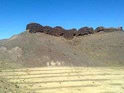
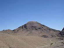
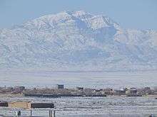
Kūh-e Tīr Māhī (persian: کوه تیر مهی) or Kuh-e Zibad [1] is a mountain in the province of Razavi Khorasan, city of Gonabad District Zibad in the eastern part of the country, 700 km east of the capital Tehran. The top of the Kuh-e Tir Mahi is 2,557 metres (8,389 ft) above sea level, or 431 m (1,414 ft) above the surrounding terrain . The width at the base is 5.5 km.
Zibad Gonabad
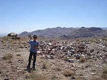
The terrain around the Kuh-e Tir Mahi is mainly hilly. The highest point in the vicinity is 2775 meters above sea level, 17.7 km southeast of Kuh-e Tir mahi. Around Kuh-e Tir Mahi is very sparsely populated, with 5 inhabitants per square kilometer. Nearest society Sanu, 8.5 km north of Kuh-e Tir mahi. The neighborhood around Kuh-e Tir Mahi is barren with little or vegetation. In the neighborhood around the Kuh-e Tir mahi are unusually many named mountains and valleys.
A cold steppe climate prevailing in the region. The average annual temperature in the area is 17 °C. The warmest month is July when the average temperature is 30 °C, and the coldest is January, with 1 °C. Average annual rainfall is 211 mm (8 in). The rainiest month is February, with an average of 58 mm (2 in) of precipitation, and the driest is July, with 1 mm of precipitation.
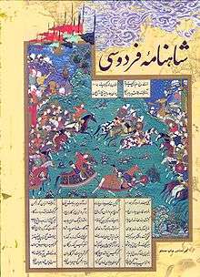
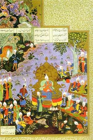
This mountain had been referred in shahnameh in Davazdah Rokhwar as the Zibad mountain.
| Kūh-e Tīr Māhī
|
|---|
| Climate chart (explanation) |
|---|
| J | F | M | A | M | J | J | A | S | O | N | D |
|
|
|
|
|
|
|
|
|
|
|
|
| Average max. and min. temperatures in °C |
| Precipitation totals in mm | | Source: [2] |
|
| Imperial conversion |
|---|
| J | F | M | A | M | J | J | A | S | O | N | D |
|
|
|
|
|
|
|
|
|
|
|
|
| Average max. and min. temperatures in °F |
| Precipitation totals in inches |
|
Sources
Article in Persian language. Parssea magazine,2011
- geoghraphy and tribe and minority in khorasan,Mohammad Ajam, research published 1992, university of Imam Sadegh,Tehran.
References
 |
Wikimedia Commons has media related to Zibad. |
- ↑ [Template:Geonameslänk Kūh-e Tīr Māhī] hos [Template:Geonamesabout Geonames.org (cc-by)]; post uppdaterad 2012-04-06; databasdump nerladdad 2016-08-15
- ↑ "NASA Earth Observations Data Set Index". NASA. Retrieved 2017-01-30.
|
|---|
| Characters | | |
|---|
Creatures
& animals | |
|---|
| Places | |
|---|
| Structures |
- Gonbadan Castle
- Dez-i Roein
- White Castle
- Bahman Castle
- Dez-i Alanan
- Kang-dez
|
|---|
| Manuscripts | |
|---|
| See also | |
|---|
 Category Category Book Book
|

.png)