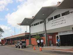
Josefa Camejo International Airport
| Josefa Camejo International Airport | |||||||||||
|---|---|---|---|---|---|---|---|---|---|---|---|
 | |||||||||||
| Summary | |||||||||||
| Airport type | Public | ||||||||||
| Location | Los Taques Municipality, Venezuela | ||||||||||
| Elevation AMSL | 75 ft / 23 m | ||||||||||
| Coordinates | 11°46′50″N 70°09′00″W / 11.78056°N 70.15000°W | ||||||||||
| Map | |||||||||||
.svg.png) LSP Location of airport in Venezuela | |||||||||||
| Runways | |||||||||||
| |||||||||||
Josefa Camejo International Airport (IATA: LSP, ICAO: SVJC), is an airport serving the Paraguaná Peninsula in Venezuela. The airport is named in honor of Josefa Camejo (es),[3] a heroine of the Venezuelan War of Independence.
On May 22, 2018, Aruba Airlines inaugurated what, according to Travel and Leisure Magazine is the world's shortest international flight. linking the airport with Aruba Airline's hub in Orangestad, [4] a flight that lasts approximately eight minutes each way.
Facilities
Runway length does not include a 500 metres (1,600 ft) paved overrun on the east end. The Paraguana non-directional beacon (Ident: PRG) and VOR-DME (Ident: PRG) are located on the field.[5][6]
Airlines and destinations
Passenger
| Airlines | Destinations |
|---|---|
| Albatros Airlines | Aruba, Caracas, Curaçao |
| Aruba Airlines | Aruba |
| Conviasa | Caracas |
| Turpial Airlines | Valencia (VE) |
Cargo
| Airlines | Destinations |
|---|---|
| Amerijet International | Miami |
Accidents and incidents
- On Monday 5 December 2011, a flight from Aruba by the company Tiara Air departing from Josefa Camejo International Airport was on the runway going at full speed to depart when a donkey appeared on the runway. The aircraft, a Shorts 360, hit the donkey with the right main gear; the pilots kept climbing and continued the flight to Aruba for an emergency landing, which was performed safely with no injury on board.[7]
See also
References
External links
- OurAirports - Paraguana
- SkyVector - Paraguana
- OpenStreetMap - Paraguana
- Airport information for Josefa Camejo International Airport at World Aero Data. Data current as of October 2006.
This article is issued from
Wikipedia.
The text is licensed under Creative Commons - Attribution - Sharealike.
Additional terms may apply for the media files.