Jong River
| Jong River | |
| Taia River | |
| River | |
| Country | Sierra Leone |
|---|---|
| Province | Eastern, Southern |
| Tributaries | |
| - left | Bende Creek, Yaigini Creek |
| Source | |
| - location | Confluence of the Pampana River and Teye River |
| - elevation | 63 m (207 ft) |
| - coordinates | 8°23′27″N 11°59′50″W / 8.3907°N 11.9973°W |
| Mouth | Sherbro River (Atlantic Ocean) |
| - elevation | 0 m (0 ft) |
| - coordinates | 7°33′14″N 12°21′17″W / 7.5540°N 12.3546°WCoordinates: 7°33′14″N 12°21′17″W / 7.5540°N 12.3546°W |
| Length | 249 km (155 mi) |
| Basin | 7,500 km2 (2,896 sq mi) |
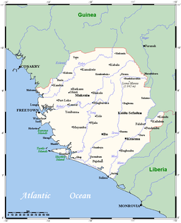 Map of Sierra Leone with Jong River. | |
The Jong or Taia river is a river flowing through Sierra Leone. It passes by the city of Mattru Jong,[1] and flows into the Atlantic Ocean via some deltas.[2]
References
- ↑ http://www.sierra-leone.org/villagenames.html
- ↑ West Africa Topographical Maps, Series N504, 1:250,000, U.S. Army Map Service, 1955
This article is issued from
Wikipedia.
The text is licensed under Creative Commons - Attribution - Sharealike.
Additional terms may apply for the media files.