Jones, Alabama
| Jones, Alabama | |
|---|---|
| Unincorporated community | |
 Jones Location within the state of Alabama  Jones Jones (the US) | |
| Coordinates: 32°35′2″N 86°53′50″W / 32.58389°N 86.89722°WCoordinates: 32°35′2″N 86°53′50″W / 32.58389°N 86.89722°W | |
| Country | United States |
| State | Alabama |
| County | Autauga |
| Elevation | 200 ft (60 m) |
| Time zone | UTC-6 (Central (CST)) |
| • Summer (DST) | UTC-5 (CDT) |
| ZIP code | 36749 |
| Area code(s) | 334 |
Jones, originally Jones Switch, is an unincorporated community in Autauga County, Alabama, United States.[1] The name was officially shortened on May 1, 1903. The community has a post office, with postmasters appointed from 1878 to 2006.[2][3] The post office also serves unincorporated areas of Autauga County such as Vine Hill, Fremont, Bethel, Salem, Milton, and Fig Tree.
Geography
Jones is located at 32°35′02″N 86°53′51″W / 32.58402°N 86.89748°W and has an elevation of 200 feet (61 m).[1] Mulberry Creek is located to the west and rolling hills are located to the east.
References
- 1 2 U.S. Geological Survey Geographic Names Information System: Jones
- ↑ U.S. Geological Survey Geographic Names Information System: Jones Post Office
- ↑ "Postmasters by City". Postmaster Finder. United States Postal Service. Retrieved July 27, 2011.
Municipalities and communities of Autauga County, Alabama, United States | ||
|---|---|---|
| Cities | 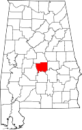 | |
| Towns | ||
| CDPs | ||
| Unincorporated communities | ||
| Ghost town | ||
| Footnotes | ‡This populated place also has portions in an adjacent county or counties | |
This article is issued from
Wikipedia.
The text is licensed under Creative Commons - Attribution - Sharealike.
Additional terms may apply for the media files.