Jim Kelly Peak
| Jim Kelly Peak | |
|---|---|
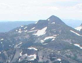 Northern flank of Jim Kelly Peak | |
| Highest point | |
| Elevation | 2,107 m (6,913 ft) |
| Prominence | 237 m (778 ft) |
| Listing | List of volcanoes in CanadaList of Cascade volcanoes |
| Coordinates | 49°40′41″N 121°02′28.99″W / 49.67806°N 121.0413861°W |
| Geography | |
| Location | British Columbia, Canada |
| Parent range | Bedded Range |
| Topo map | NTS 92H/11 |
| Geology | |
| Mountain type | Lava dome |
| Volcanic arc/belt |
Pemberton Volcanic Belt Canadian Cascade Arc |
Jim Kelly Peak, also called Jim Kelly Mountain and Mount Jim Kelly, is the unofficial name conferred by bivouac.com[1] for a mountain in southwestern British Columbia, Canada, located 11 km (6.8 mi) south of Falls Lake and 20 km (12 mi) west of Tulameen. It lies in the Bedded Range of the northern Canadian Cascades.
The mountain is a lava dome composed of andesite only 1 km (0.62 mi) away from the eastern flank of Coquihalla Mountain, a larger but more rugged volcano. These two volcanoes form part of the deeply eroded Pemberton Volcanic Belt, which forms the oldest part of the Canadian Cascade Arc.
References
- ↑ "Jim Kelly Peak". Bivouac.com. Retrieved 2010-06-02.
Coordinates: 49°31′40″N 121°02′27″W / 49.52778°N 121.04083°W
This article is issued from
Wikipedia.
The text is licensed under Creative Commons - Attribution - Sharealike.
Additional terms may apply for the media files.