Jialishan Range
| Jialishan Range | |
|---|---|
|
加里山山脈 | |
 The mountain which has a height of 2,220 m., also known as Mt. Jiali or Jiali Shan, in Miaoli County | |
| Highest point | |
| Peak | Mount Le (Chinese: 樂山; pinyin: Lèshān) |
| Elevation | 2,618 m (8,589 ft) |
| Coordinates | 24°29′55″N 121°04′13″E / 24.4985°N 121.0704°ECoordinates: 24°29′55″N 121°04′13″E / 24.4985°N 121.0704°E |
| Geography | |
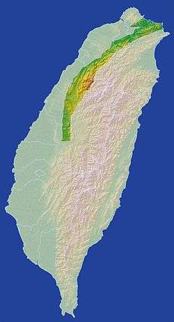 The location of Jialishan Range.
| |
| Location |
|
| Geology | |
| Mountain type | Mountain range |
Jialishan Range (Chinese: 加里山山脈) is a mountain range in northern Taiwan. It is also regarded as the northern part of "Western Thrust Fault Mountains" (西部衝上斷層山地) by Tomita Yoshirou and Lin Chaoqi.
Although it is named as "Range", some scholars think it only is a piedmont belt. It does not find a mention in the geography textbooks of elementary schools and high schools. The reason is Jialishan Range was cut by several rivers.
The tallest peak of Jialishan Range is Mount Le (樂山), which has a height of 2,618 m.
Location
Jialishan Range faces the Xueshan Range on the east and Alishan Range on the south.
Including
- Shen'ao Mountains
- Sandiouling Mountains
- Nangang Range
- Fushishan Range
- Wuzhishan Range
- Dajianshan Range
- Wanli Mountains
- Shanzijiou Block
- Qingshukeng Block
- Daxi Mountains
- Xiongkongshan Range
- Youloushan Range
- Leshan Range
- Shitoushan Mointains
- Baguali Range
- Malabang Range
- Bajioudong Range
- Guandaoshan Range
- Dahu Hills
- Dongshi Hills
- Fengyuan Hills
- Chuyunshan Range
- Dahengpingshan Range
- Nantou Hills
- Jijidashan Range
External links
![]()
This article is issued from
Wikipedia.
The text is licensed under Creative Commons - Attribution - Sharealike.
Additional terms may apply for the media files.