Jemez River
| Jemez River | |
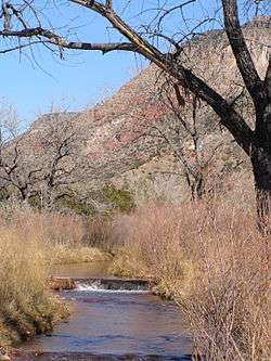 Jemez River downstream from Jemez Pueblo | |
| Country | United States |
|---|---|
| State | New Mexico |
| County | Sandoval |
| Source | Confluence of San Antonio Creek and East Fork Jemez River |
| - location | Jemez Mountains |
| - coordinates | 35°51′57″N 106°38′21″W / 35.86583°N 106.63917°W [1] |
| Mouth | Rio Grande |
| - coordinates | 35°22′9″N 106°30′52″W / 35.36917°N 106.51444°WCoordinates: 35°22′9″N 106°30′52″W / 35.36917°N 106.51444°W [1] |
| Length | 80 mi (129 km) [2] |
| Basin | 1,038 sq mi (2,688 km2) [3] |
| Discharge | for USGS gage 08329000, 2 miles above mouth |
| - average | 59.5 cu ft/s (1.7 m3/s) [3] |
| - max | 3,640 cu ft/s (103.1 m3/s) |
| - min | 0 cu ft/s (0.0 m3/s) |
 Location of the mouth of the Jemez River in New Mexico | |
| Official name | Jemez (East Fork) |
| Type | Wild, Scenic, Recreational |
| Designated | June 6, 1990 |
The Jemez River is a tributary of the Rio Grande in the U.S. state of New Mexico. The river is formed by the confluence of the East Fork Jemez River and San Antonio Creek, which drain a number of tributaries in the area of the Jemez Mountains and Santa Fe National Forest. The Jemez River is about 50 miles (80 km) long, or about 80 miles (130 km) long if its longest headwater tributary, San Antonio Creek, is included. The East Fork Jemez River is about 22 miles (35 km) long. Both San Antonio Creek and the East Fork Jemez River flow through intricate meanders along their courses.[2] The East Fork Jemez is a National Wild and Scenic River.[4]
It flows generally south to join the Rio Grande near Bernalillo, north of Albuquerque.[5]
Course
The main tributaries streams that join to form the Jemez River are San Antonio Creek,[6] and the East Fork Jemez River.[7] Both originate on the west side of the Sierra de los Valles near the northwest corner of Los Alamos County. San Antonio Creek flows west in a northward curve, through Valle Toledo[8] and Valle San Antonio.[9] The East Fork Jemez River flows west in a southward curve, through Valle Grande.[10] These valleys are all part of the Valles Caldera. The two tributary streams join near Battleship Rock[11] in Cañon de San Diego,[12] forming the Jemez River's main stem.
The Jemez River flows south through the Cañon de San Diego, between the Jemez Mountains and the Nacimiento Mountains to Jemez Springs, and continues south through the canyon to its confluence with the Rio Guadalupe,[13] near Cañones and Cañon. From there the Jemez River continues south, passing through the Jemez Indian Reservation, where some of its water is diverted into irrigation canals. Vallecito Creek joins the Jemez River near Jemez Pueblo. A few miles to the south the Jemez River enters the Zia Indian Reservation and is joined by the Rio Salado, about four miles upstream from Zia Pueblo. The river's course bends slightly to the southeast and it enters the Santa Ana Indian Reservation, passing by the Santa Ana Pueblo, located at the upper end of the Jemez Canyon Reservoir. The reservoir is created by the Jemez Canyon Dam and is entirely within the Santa Ana Reservation. Below the dam the Jemez River flows about three miles to its confluence with the Rio Grande, a few miles north of Bernalillo.[5]
See also
References
- 1 2 U.S. Geological Survey Geographic Names Information System: Jemez River
- 1 2 Lengths calculated in Google Earth
- 1 2 "Water resources data for the United States, Water Year 2009; gage 08329000, Jemez River below Jemez Canyon Dam, NM" (PDF). USGS. Retrieved 20 July 2010.
- ↑ "East Fork of the Jemez Wild and Scenic River, New Mexico". The Wild & Scenic Rivers Council. Retrieved 22 October 2011.
- 1 2 General course info from USGS topographic maps
- ↑ U.S. Geological Survey Geographic Names Information System: San Antonio Creek
- ↑ U.S. Geological Survey Geographic Names Information System: East Fork Jemez River
- ↑ U.S. Geological Survey Geographic Names Information System: Valle Toledo
- ↑ U.S. Geological Survey Geographic Names Information System: Valle San Antonio
- ↑ U.S. Geological Survey Geographic Names Information System: Valle Grande
- ↑ U.S. Geological Survey Geographic Names Information System: Battleship Rock
- ↑ U.S. Geological Survey Geographic Names Information System: Cañon de San Diego
- ↑ U.S. Geological Survey Geographic Names Information System: Rio Guadalupe