Jabłonka, Lesser Poland Voivodeship
| Jabłonka | |
|---|---|
| Village | |
 Jabłonka | |
 Jabłonka | |
| Coordinates: 49°28′48″N 19°41′36″E / 49.48000°N 19.69333°ECoordinates: 49°28′48″N 19°41′36″E / 49.48000°N 19.69333°E | |
| Country |
|
| Voivodeship | Lesser Poland |
| County | Nowy Targ |
| Gmina | Jabłonka |
| Population | 4,400 |
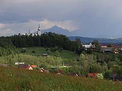
Jabłonka [jaˈbwɔnka] (Slovak: Jablonka) is a village in Nowy Targ County, Lesser Poland Voivodeship, in southern Poland, close to the border with Slovakia. It is the seat of the gmina (administrative district) called Gmina Jabłonka. It lies approximately 24 kilometres (15 mi) west of Nowy Targ and 67 km (42 mi) south of the regional capital Kraków .[1] The village has a population of 4,400.
The village lies in the drainage basin of the Black Sea (through Orava, Váh and Danube rivers), in the historical region of Orava (Polish: Orawa, Hungarian: Árva county), which since the Middle Ages until the end of the First World War belonged to Kingdom of Hungary.
References
| Wikimedia Commons has media related to Jabłonka (województwo małopolskie). |
| Seat |  | |
|---|---|---|
| Other villages | ||
This article is issued from
Wikipedia.
The text is licensed under Creative Commons - Attribution - Sharealike.
Additional terms may apply for the media files.