Itanos
| Itanos Ίτανος | |
|---|---|
 Itanos Location within the regional unit 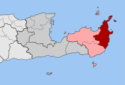 | |
| Coordinates: 35°12′N 26°15′E / 35.200°N 26.250°ECoordinates: 35°12′N 26°15′E / 35.200°N 26.250°E | |
| Country | Greece |
| Administrative region | Crete |
| Regional unit | Lasithi |
| Municipality | Siteia |
| • Municipal unit | 197.4 km2 (76.2 sq mi) |
| Population (2011)[1] | |
| • Municipal unit | 2,108 |
| • Municipal unit density | 11/km2 (28/sq mi) |
| Time zone | UTC+2 (EET) |
| • Summer (DST) | UTC+3 (EEST) |
| Vehicle registration | AN |
Itanos (Greek: Ίτανος) is a former municipality in the Lasithi regional unit, eastern Crete, Greece. Since the 2011 local government reform it is part of the municipality Siteia, of which it is a municipal unit.[2] The municipal unit has an area of 197.406 km2 (76.219 sq mi).[3] Its territory is rich in ancient archaeological sites, notably a Minoan city in Roussolakkos and the ancient Greek city Itanos in Erimopolis. The Minoan settlement was called Utana (cf. Linear B U-ta-ni-yo [KN E 749]). Herodotus recorded that the settlers from Thera (modern Santorini) who founded Cyrene owed their knowledge of the coast to an Itanian trader named Corobios.
Population 2,108 (2011). The seat of the municipality was in Palaikastro.
References
- ↑ "Απογραφή Πληθυσμού - Κατοικιών 2011. ΜΟΝΙΜΟΣ Πληθυσμός" (in Greek). Hellenic Statistical Authority.
- ↑ Kallikratis law Greece Ministry of Interior (in Greek)
- ↑ "Population & housing census 2001 (incl. area and average elevation)" (PDF) (in Greek). National Statistical Service of Greece. Archived from the original (PDF) on 2015-09-21.
This article is issued from
Wikipedia.
The text is licensed under Creative Commons - Attribution - Sharealike.
Additional terms may apply for the media files.