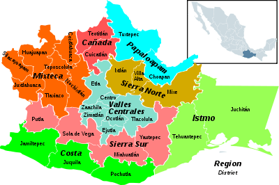
Istmo de Tehuantepec
| Istmo de Tehuantepec | |
|---|---|
| Region | |
 Oaxaca regions - Istmo de Tehuantepec to the east | |
| Coordinates: 16°10′57″N 95°11′45″W / 16.18250°N 95.19583°WCoordinates: 16°10′57″N 95°11′45″W / 16.18250°N 95.19583°W | |
| Country | Mexico |
| State | Oaxaca |
| Area | |
| • Total | 19,977 km2 (7,713 sq mi) |
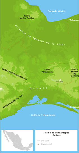
Istmo de Tehuantepec is the largest region of the state of Oaxaca, located in southwestern Mexico.
Geography
It covers the southern part of the Isthmus of Tehuantepec, the shortest route between the Gulf of Mexico and the Pacific Ocean before the Panama Canal was opened.
The Istmo region has two districts, Juchitán District and Tehuantepec District, and a totl of 41 municipalities.[1]
The region contain the largest part of the Selva Zoque (Zoque Forest) ecological region, that extends into adjacent Veracruz and Chiapas states. [2] It is an area of significant ecological importance, including the largest intact tropical cloud forest in Central America. It also has lowland tropical rainforests, tropical dry forests, Sierra Madre de Oaxaca pine-oak forests and Sierra Madre del Sur pine-oak forests, and Central American montane forests. The forest is also home to 300 species of native orchids, representing 27% of known Mexican orchid species and 60% of recorded Mexican orchid genera. [3]
Economy
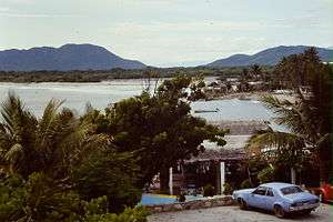
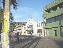
The region has cement and lime plants. The main industry is the Pemex oil refinery in the port of Salina Cruz, the largest city in Istmo de Tehuantepec, located on the Pacific coast at the Gulf of Tehuantepec. The isthmus has extensive livestock production operations. Crops include sesame, coffee, rice, sorghum, pineapple, banana, coconut, melon, and sugarcane. Fishing cooperatives harvest shrimp and other seafood from the Pacific.
The government has plans to develop the trans-Isthmus of Tehuantepec corridor, including improving transportation routes, developing an industrial zone along the highway, and expanding the petroleum and petrochemical industries in Salina Cruz. Other plans include creating coffee plantations and cattle corridors; expanding production of beans, maize, and chili; and exploiting the bio-genetic resources of native medicinal plants.[4]
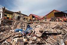
2017 Chiapas earthquake
The 2017 Chiapas earthquake severely damaged buildings in the region on 7 September 2017. It measured 8.2 on the moment magnitude scale and a maximum Mercalli intensity of IX (Violent) and occurred approximately 87 kilometres (54 mi) south of Pijijiapan off the Chiapas coast in the Gulf of Tehuantepec.[5][6]
See also
- Istmo de Tehuantepec Region topics
References
- ↑ "Región Papaloapam". Enciclopedia de los Municipios de México. Archived from the original on 2011-06-16. Retrieved 2010-07-06.
- ↑ Carlos Slim Foundation: Selva Zoque, "Oaxaca representa 60% of WWF ecoregion"
- ↑ Birdlife.org: "Forests of Hope site - Selva Zoque, Mexico"
- ↑ Emanuel Gómez (March 2002). "El futuro de la Selva Zoque". La Jornada, Suplemento Ojarasca Nº 59 (in Spanish). Retrieved 2010-06-27.
- ↑ "Earthquake of magnitude 8.1 strikes off Mexico's Pacific coast". BBC News. 8 September 2017. Retrieved 8 September 2017.
- ↑ "M 8.1 - 87km SW of Pijijiapan, Mexico". United States Geological Survey. Retrieved 7 September 2017.
External links
| Wikimedia Commons has media related to |