Islandeady Lough
| Islandeady Lough Loch Oileán Éadaí | |
|---|---|
 | |
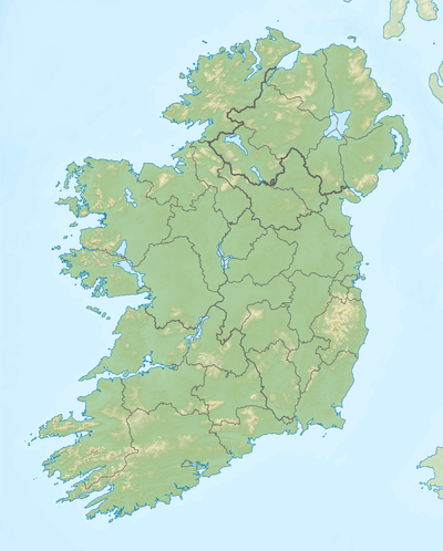 Location in Ireland | |
| Location | County Mayo |
| Coordinates | 53°49′49″N 9°23′3″W / 53.83028°N 9.38417°WCoordinates: 53°49′49″N 9°23′3″W / 53.83028°N 9.38417°W |
| Primary outflows | Castlebar River |
| Catchment area | 55.94 km2 (21.6 sq mi) |
| Basin countries | Ireland |
| Max. length | 1.7 km (1.1 mi) |
| Max. width | 1.1 km (0.7 mi) |
| Surface area | 1.39 km2 (0.54 sq mi) |
| Surface elevation | 27 m (89 ft) |
| References | [1][2][3] |
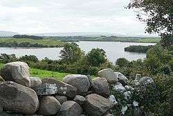
Islandeady Lough (Irish: Loch Oileán Éadaí)[1] is a freshwater lake in the west of Ireland. It is located in County Mayo.
Geography
Islandeady Lough measures about 2 km (1.2 mi) long and 1 km (0.6 mi) wide. It is located about 10 km (6 mi) west of Castlebar.[2]
Hydrology and natural history
Islandeady Lough drains to neighbouring Castlebar Lough via the Castlebar River. The river in turn flows through Lough Lannagh before passing through Castlebar.[2] Islandeady Lough is stocked annually with brown trout.[4]
See also
References
- 1 2 "Loch Oileán Éadaí/Islandeady Lough". Placenames Database of Ireland. Government of Ireland - Department of Arts, Heritage and the Gaeltacht and Dublin City University. Retrieved 30 Dec 2015.
- 1 2 3 Google (30 Dec 2015). "Islandeady Lough" (Map). Google Maps. Google. Retrieved 30 Dec 2015.
- ↑ "A Reference Based Typology and Ecological Assessment System for Irish Lakes" (PDF). Environmental Protection Agency (Ireland). 2006. p. 18. Retrieved 30 Dec 2015.
- ↑ "Trout fly fishing in Mayo". Inland Fisheries Ireland. Retrieved 30 Dec 2015.
This article is issued from
Wikipedia.
The text is licensed under Creative Commons - Attribution - Sharealike.
Additional terms may apply for the media files.