Isla Iguana Wildlife Refuge
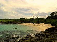 Isla Iguana Lighthouse in 2013 | |
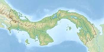 Panama | |
| Location |
Isla Iguana Los Santos Province Panama |
|---|---|
| Coordinates | 7°37′42.6″N 79°59′52.6″W / 7.628500°N 79.997944°W |
| Foundation | concrete base |
| Construction | metal skeletal tower |
| Tower shape | square pyramidal skeletal tower with balcony and light |
| Markings / pattern | white tower |
| Height | 12 metres (39 ft) |
| Focal height | 25 metres (82 ft) |
| Light source | solar power |
| Range | 10 nautical miles (19 km; 12 mi) |
| Characteristic | Fl W 13s. |
| Admiralty number | G3243 |
| NGA number | 0047 |
| ARLHS number | PAN-005[1] [2] |
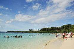
The Isla Iguana Wildlife Refuge is a 58-hectare wildlife reserve located 5 kilometers off the Los Santos Province on the Azuero Peninsula in Panama.
History
During World War II, the United States Army used the Isla Iguana Wildlife Refuge as a bombing range. To clear the area, two thousand-pound bombs stuck in the surrounding coral reef were detonated in the 1990s.
In the 1960s, a settler on the northern part of the island claimed it as his property and planted exotic plants such as mango and guava trees, corn and sugar cane. These non-native plants still inhabit the island to this day. Late in the decade, the man was removed by the government.
The Isla Iguana Wildlife Refuge was declared protected on June 15, 1981.
Wildlife
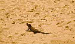
Native animals include crabs (among them hermit crabs), black and green iguanas, boa constrictors, and red throated frigates. It is a vital nesting ground for several species of frigate as well as sea turtles.
See also
References
- ↑ Southern Panamá The Lighthouse Directory. University of North Carolina at Chapel Hill. Retrieved 24 January 2017
- ↑ List of Lights, Pub. 111: The West Coasts of North and South America (Excluding Continental U.S.A. and Hawaii), Australia, Tasmania, New Zealand, and the Islands of the North and South Pacific Oceans (PDF). List of Lights. United States National Geospatial-Intelligence Agency. 2016.
External links
Coordinates: 7°37′44″N 79°59′53″W / 7.629°N 79.998°W