Iskander Darya
Coordinates: 39°11′20″N 68°32′18″E / 39.18889°N 68.53833°E
| Iskander Darya | |
|---|---|
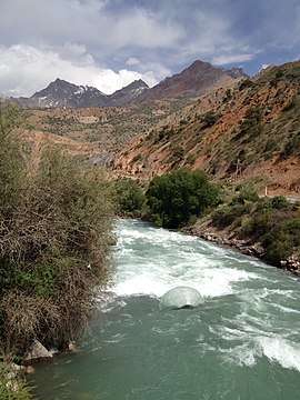 Iskander Darya near river head | |
| Country | Tajikistan |
| Physical characteristics | |
| River mouth | Fan Darya |
| Length | 20 km (12 mi) |
| Discharge |
|
| Basin features | |
| Basin size | 950 square kilometres (370 sq mi) |
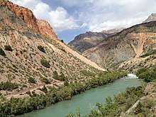
Iskander Darya in higher reaches
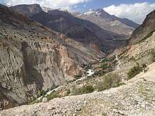
Valley of Iskander Darya in higher reaches
The Iskander Darya (Tajik: Искандардарё), is a river in Ayni District of Sughd Province, Tajikistan. The Iskander Darya is 20 kilometres (12 mi) long, and the area of its drainage basin is 950 square kilometres (370 sq mi). It is a major left tributary of the Fan Darya.[1][2]
The Iskander Darya River has its source in Lake Iskanderkul and flows east. The mouth of Iskander Darya is about the village of Zarafshan.[3] River merges with the Yaghnob River at an altitude of around 1640 m, forming the Fan Darya.[1]
References
This article is issued from
Wikipedia.
The text is licensed under Creative Commons - Attribution - Sharealike.
Additional terms may apply for the media files.