Ishtori Haparchi
Ishtori Haparchi (1280-1355), also Estori Haparchi and Ashtori ha-Parhi (Hebrew: אשתורי הפרחי) is the pen name of the 14th-century Jewish physician, geographer, and traveller, Isaac HaKohen Ben Moses.[1]
Pen name
The name HaParchi means "the Florentine" in Hebrew (perach is Hebrew for flower). He is commonly known by the title Kaftor va-Ferach taken from the name of his work,[2] the expression being additionally a pun on his surname.
Ish Tori, as he refers to himself in his book, means "Man of Tours", the capital of the medieval French county of Touraine.[2]
Biography
Ishtori Haparchi was born in France in 1280. Haparchi was descended from a line of sages and rabbis of fame. His Father was Rabbi Moshe HaParhi, a distinguished Talmudical scholar. His grandfather was Rabbi Nathan of Trinquetaille, author of "Shaar HiTefisa"[3] His great grandfather was Meir ben Isaac of Carcassonne, author of the "Sefer ha-'Ezer". According to one biographer, his family originally came from "Florenzia, Spain".[3]
When the Jews were expelled from France in 1306, he travelled to Spain and Egypt, and then settled in the Land of Israel (Eretz Yisrael in Hebrew). He worked as a physician in Bet She'an, where he died in 1355.
Writings
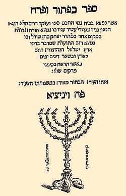
Ishtori Haparchi was the author of the first Hebrew book on the geography of the Land of Israel,[4] Sefer Kaftor va-Ferach (Hebrew: ספר כפתור ופרח), literally "Book of Bulb and Flower",[2] written in 1322 in the Land of Israel and published in Venice in 1549.[3] "Bulb and Flower" is a Hebrew idiom derived from the description of the menorah in the Jerusalem Temple (Exodus 37:17) and means a "work of art". In the context of the book it refers to the lay of the land. Haparchi lists the names of towns and villages in the Land of Israel and discusses the topography of the land based on first-hand visits to the sites. Modern scholarship has determined that most of the 180 ancient sites he identified were correct, among them Usha, Modi'in and Betar.[1]
Editions
- Edelmann, Ẓevi Hirsch, ed. (1852). ספר כפתור ופרח (in Hebrew). Berlin: Y. Ziṭṭenfeld.
- Luncz, Abraham Moses, ed. (1899). ספר כפתור ופרח (in Hebrew).
References
- 1 2 Encyclopedia Judaica Keter, Jerusalem, 1972, "Estori Ha-Parchi," vol. 6, p.918. Yeshurun vol. 21 p. 855
- 1 2 3 Ronald L. Eisenberg, Essential Figures in Jewish Scholarship, p. 72, Eshtori (Ishtori) ha-Parchi (France, 1280-1355). Accessed 8 October 2018.
- 1 2 3 "A History of Rabbi Ishtori HaParhi: The first researcher into the land of Israel". Les Fleurs de l'Orient. Retrieved 31 July 2017.
- ↑ "Ashtori ha-Parḥi (Jewish topographer)". Britannica Online Encyclopedia. Encyclopædia Britannica. Retrieved 2011-03-25.
| Authority control |
|---|