Isdalstø
| Isdalstø Isdalsstø | |
|---|---|
| Village | |
 Isdalstø Location in Hordaland county  Isdalstø Isdalstø (Norway) | |
| Coordinates: 60°33′19″N 05°16′09″E / 60.55528°N 5.26917°ECoordinates: 60°33′19″N 05°16′09″E / 60.55528°N 5.26917°E | |
| Country | Norway |
| Region | Western Norway |
| County | Hordaland |
| District | Nordhordland |
| Municipality | Lindås |
| Elevation[1] | 7 m (23 ft) |
| Time zone | UTC+01:00 (CET) |
| • Summer (DST) | UTC+02:00 (CEST) |
| Post Code | 5916 Isdalstø |
Isdalstø or Isdalsstø is a village in Lindås municipality in Hordaland county, Norway.
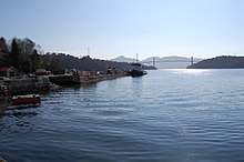
View of the local docks in Isdalstø
The village lies along the southern end of the Radfjorden between the villages of Alversund and Knarvik. It was a central hub for ferry traffic until the 1970s.
References
- ↑ "Isdalstø" (in Norwegian). yr.no. Retrieved 2014-03-24.
This article is issued from
Wikipedia.
The text is licensed under Creative Commons - Attribution - Sharealike.
Additional terms may apply for the media files.