Irmak, Kırıkkale
| Irmak | |
|---|---|
| Village | |
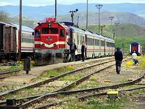 Irmak railway station. | |
 Irmak Location in Turkey | |
| Coordinates: 39°55′58″N 33°23′20″E / 39.9328°N 33.3890°ECoordinates: 39°55′58″N 33°23′20″E / 39.9328°N 33.3890°E | |
| Country |
|
| Province | Kırıkkale |
| District | Yahşihan |
| Government | |
| • Muhtar | Mustafa Çayır |
| Elevation | 696 m (2,284 ft) |
| Population (2016) | |
| • Total | 1,171[1] |
| Time zone | UTC+3 (FET) |
| Postal code | 71450 |
Irmak is a village in the Yahşihan district of Kırıkkale Province in Turkey. As of 2016, the village has a population of 1,171, which has been in decline since at least 2013.[1]
Irmak is most notable for the railway junction located just north of the village. TCDD Taşımacılık operates two trains that stop at Irmak railway station. Once construction of the Başkentray commuter rail system in Ankara is complete, more trains will service the station. The D.200 state highway bypasses the village along its southern perimeter.
Irmak is about 12.5 km (7.8 mi) northwest of Kırıkkale, the provincial capital, and about 39.6 km (24.6 mi) east of Ankara, the capital of Turkey.
References
- 1 2 "Irmak Köyü Nüfusu" (in Turkish). Retrieved 16 October 2017.
This article is issued from
Wikipedia.
The text is licensed under Creative Commons - Attribution - Sharealike.
Additional terms may apply for the media files.