Irele
| Irele Ode Irele | |
|---|---|
| LGA and town | |
 Irele Location in Nigeria | |
| Coordinates: 6°29′0″N 4°52′0″E / 6.48333°N 4.86667°ECoordinates: 6°29′0″N 4°52′0″E / 6.48333°N 4.86667°E | |
| Country |
|
| State | Ondo State |
| Time zone | UTC+1 (WAT) |
Irele is a Local Government Area in Ondo State, Nigeria. Its headquarters are in the town of Ode-Irele.
It has an area of 963 square kilometres (372 sq mi) and had a population of 145,166 at the 2006 census.
The postal code of the area is 352.[1]
Notes and references
- ↑ "Post Offices- with map of LGA". NIPOST. Archived from the original on 7 October 2009. Retrieved 2009-10-20.
State capital: Akure | ||
| Local Government Areas | 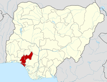 | |
This article is issued from
Wikipedia.
The text is licensed under Creative Commons - Attribution - Sharealike.
Additional terms may apply for the media files.