Interstate 84 in Idaho
| ||||
|---|---|---|---|---|
| Vietnam Veterans Memorial Highway | ||||
|
I-84 highlighted in red | ||||
| Route information | ||||
| Maintained by ITD | ||||
| Length | 275.650 mi[1] (443.616 km) | |||
| Major junctions | ||||
| West end |
| |||
| East end |
| |||
| Location | ||||
| Counties | Payette, Canyon, Ada, Elmore, Gooding, Jerome, Minidoka, Cassia, Oneida | |||
| Highway system | ||||
| ||||

Interstate 84 (I-84) in the U.S. state of Idaho, also known as The Vietnam Veterans Memorial Highway,[2] heads southeast from the Oregon state line near Fruitland. It connects via I-184 to Boise. Eventually, I-84 connects to Interstate 86, and mainline I-84 heads southeast towards Utah. I-86 continues due east and heads to Pocatello, meeting with I-15. I-84 exits the state to the southeast at the Utah state line near the town of Stone.
Route description
Eastbound from Oregon, Interstate 84 enters Idaho after crossing the Snake River at an approximate elevation of 2,150 feet (660 m) above sea level. The highway proceeds southeast, passing the community of Fruitland, and reaching an interchange (#3) with U.S. Route 95. It continues southward through rural agricultural area, reaching interchanges with U.S. Route 30 (and Old U.S. 30) as well as passing numerous small buildings. The road continues southeast, traveling parallel to Old U.S. Route 30, reaching an interchange with State Highway 44 from Middleton. The roadway proceeds, interchanging with U.S. Route 20/26, which continue concurrently with the highway.
Interstate 84 Business splits off in Caldwell, while I-84 interchanges with 10th Avenue before U.S. 20/26 split off the roadway. The highway continues southeast through Caldwell, then bends east and enters Nampa. I-84 Business returns to the parent route within the city. Adding lanes, the highway continues through Meridian, reaching interchanges with several small roads.
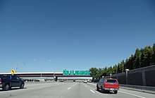
The roadway enters Boise and reaches an interchange with Interstate 184, its auxiliary route which connects to the city center. The highway turns southeast, passing Boise Airport, and interchanges with several roads, before reaching an interchange with U.S. 20/26, which continue concurrently with I-84. Southeast out of Boise, the interstate ascends past the 3,000-foot (910 m) level, enters rural desert area, and interchanges with a few small roads. It bypasses Mountain Home, where Interstate 84 Business (Old U.S. 30) splits off and enters the community. U.S. 20 splits off and heads east towards Fairfield, the way to the Sun Valley ski resort.
Mountain Home in 2016
South of Mountain Home, I-84 Business reenters the highway, which proceeds eastward, traveling upstream and parallel to the Snake River, before bypassing Glenns Ferry. The highway continues east near the river, interchanging repeatedly with Old U.S. Route 30, bypassing Bliss, where U.S. 26 splits off east to Gooding and Shoshone. The interstate bends southeast, passing through the Malad Gorge and Thousand Springs State Park, Wendell, and bypassing Jerome. It continues to an interchange with U.S. Route 93, which connects south to Twin Falls, before returning to running parallel to the Snake River.
The interstate proceeds east, now over 4,000 feet (1,220 m) in elevation, passing the Hazelton Municipal Airport, and interchanging with several small roads. It passes north of Burley, then reaches an interchange with Interstate 86, which connects to Pocatello. I-84 proceeds southeast, parallel to State Highway 81 for a short distance, then climbs Meadow Creek to an elevated area which crests at 5,530 feet (1,690 m) at Sweetzer Summit. The highway descends southeast through Juniper Valley to the state line, at 4,500 feet (1,370 m), and continues in Utah.[3]
History
Prior to the construction of I-84, the corridor was served by Idaho State Highway 2.[4]
The highway was officially designated as the Vietnam Veterans Memorial Highway in 2014, mirroring the name for Oregon's section of I-84.[5]
Future
(As of June 2008) The current pavement starting from the Broadway Interchange in Boise to just before the Cole and Overland Interchange is the original pavement built almost 40 years ago. The Idaho Transportation Department is planning to add a third and fourth lane in that area and repave the bumpy road. In the area between the Meridian Interchange and the Garrity Interchange they are currently creating a third lane due to the heavy traffic in that area. The lanes are now open between Broadway (Exit 54) and the Nampa area (Exit 38). ITD Plans to continue the lanes until about the Caldwell area.
Exit list
| County | Location | mi[1] | km | Exit | Destinations | Notes |
|---|---|---|---|---|---|---|
| Payette | | 0.000 | 0.000 | Continuation into Oregon | ||
| | 2.876 | 4.628 | 3 | Primary commercial route to north Idaho | ||
| | 9.498 | 15.286 | 9 | West end of US-30 overlap | ||
| | 12.906 | 20.770 | 13 | Black Canyon Junction | ||
| Canyon | | 17.335 | 27.898 | 17 | Sand Hollow | |
| | 24.839 | 39.974 | 25 | |||
| | 25.994 | 41.833 | 26 | West end of US-20/US-26 overlap | ||
| Caldwell | 26.723 | 43.006 | 27 | |||
| 27.620 | 44.450 | 28 | 10th Avenue – Caldwell City Center | |||
| 28.650 | 46.108 | 29 | East end of US-20/US-26 overlap | |||
| Nampa | 33.539 | 53.976 | 33 | West end of SH-55 overlap; signed as exits 33A (SH-55) and 33B (Midland Boulevard) westbound | ||
| 34.965 | 56.271 | 35 | Northside Boulevard | |||
| 35.985 | 57.912 | 36 | Franklin Boulevard | |||
| 37.945 | 61.067 | 38 | Exit for the Ford Idaho Center | |||
| Ada | Meridian | 42.000 | 67.592 | 42 | Ten Mile Road | |
| 44.007 | 70.822 | 44 | ||||
| 45.998 | 74.027 | 46 | East end of SH-55 overlap | |||
| Boise | 49.307 | 79.352 | 49 | I-184 exit 0 westbound. | ||
| 50.140 | 80.693 | 50 | Overland Road, Cole Road | Signed as exits 50A (West Overland Road) and 50B (Cole Road/Overland Road) eastbound, and 50A (Cole Road/Overland Road) and 50B (East Overland Road) westbound | ||
| 51.997 | 83.681 | 52 | Orchard Street | |||
| 53.483 | 86.073 | 53 | Vista Avenue – Boise Airport | |||
| 54.485 | 87.685 | 54 | West end of US-20/US-26 overlap | |||
| 56.932 | 91.623 | 57 | Exit for South Federal Way | |||
| | 59.510 | 95.772 | 59 | South Eisenman Road Interchange | Signed as exits 59A (South Eisenman IC) and 59B (Memory Road) eastbound | |
| | 63.517 | 102.221 | 64 | Blacks Creek Road – Kuna | ||
| | 70.772 | 113.896 | 71 | Orchard, Mayfield | ||
| Elmore | | 74.333 | 119.627 | 74 | Simco Road | |
| | 90.280 | 145.292 | 90 | |||
| Mountain Home | 95.193 | 153.198 | 95 | East end of US-20 overlap | ||
| | 99.570 | 160.242 | 99 | |||
| | 111.800 | 179.925 | 112 | |||
| | 113.856 | 183.233 | 114 | Westbound exit and eastbound entrance | ||
| | 120.149 | 193.361 | 120 | Eastbound exit and westbound entrance | ||
| | 121.094 | 194.882 | 121 | |||
| | 125.159 | 201.424 | 125 | Paradise Valley | ||
| | 128.993 | 207.594 | 129 | King Hill | ||
| Gooding | | 137.060 | 220.577 | 137 | East end of US-30 overlap | |
| | 140.405 | 225.960 | 141 | East end of US-26 overlap | ||
| | 146.870 | 236.364 | 147 | Tuttle | ||
| | 155.260 | 249.867 | 155 | |||
| | 156.581 | 251.993 | 157 | |||
| Jerome | | 165.160 | 265.799 | 165 | ||
| | 168.010 | 270.386 | 168 | |||
| | 173.013 | 278.437 | 173 | Main exit into Twin Falls via the Perrine Bridge | ||
| | 181.930 | 292.788 | 182 | |||
| | 188.301 | 303.041 | 188 | Valley Road – Hazelton, Eden | ||
| | 193.525 | 311.448 | 194 | West end of SH-25 overlap | ||
| Jerome–Minidoka county line | | 200.536 | 322.731 | 201 | East end of SH-25 overlap | |
| Minidoka | | 208.015 | 334.768 | 208 | ||
| | 210.591 | 338.913 | 211 | West end of US-30 overlap | ||
| Cassia | | 216.395 | 348.254 | 216 | ||
| | 221.880 | 357.081 | 222 | East end of US-30 overlap; former I-15W east; I-86 exit 1 westbound to 84 eastbound | ||
| | 227.950 | 366.850 | 228 | |||
| | 236.655 | 380.859 | 237 | Idahome Road | ||
| | 244.810 | 393.984 | 245 | Sublett Road – Malta | ||
| | 253.705 | 408.299 | 254 | Sweetzer Road | ||
| Oneida | | 262.512 | 422.472 | 263 | Juniper Road | |
| | 275.650 | 443.616 | Continuation into Utah | |||
1.000 mi = 1.609 km; 1.000 km = 0.621 mi
| ||||||
References
- 1 2 Idaho Transportation Department, Milepoint Log Reports Archived 2004-07-14 at the Wayback Machine.
- ↑ "Idaho S1227: "Archived copy" (PDF). Archived from the original (PDF) on 2014-12-22. Retrieved 2014-08-14. "
- ↑ Google (February 3, 2013). "Overview Map of Interstate 84 in Idaho" (Map). Google Maps. Google. Retrieved February 3, 2013.
- ↑ "Interstate 84 – Idaho". Idaho Transportation Department. May 2006. Archived from the original on September 1, 2010. Retrieved June 21, 2018.
- ↑ Russell, Betsy (August 12, 2014). "I-84 now officially Vietnam Veterans Memorial Highway". Spokesman-Review. Retrieved June 18, 2018.
External links
| Wikimedia Commons has media related to Interstate 84 in Idaho. |
Route map:
- Idaho Transportation Dept. – Milepost log – Interstate 84
- Roadcams – Interstate 84
- David Rumsey Map Collection – Historic road map (1937) – Idaho, Montana, Wyoming – Texaco (Rand McNally)
- Idaho highway map (1956) – Shell (H.M. Gousha)
| Previous state: Oregon |
Idaho | Next state: Utah |