Interstate 381 and State Route 381 (Virginia)
| ||||
|---|---|---|---|---|
| Commonwealth Avenue | ||||
|
I-381 and SR 381 highlighted in red | ||||
| Route information | ||||
| Length |
2.91 mi[1] (4.68 km)
| |||
| Existed | 1960 – present | |||
| History | I-381 designated in 1961 | |||
| Major junctions | ||||
| South end |
| |||
| North end |
| |||
| Highway system | ||||
| ||||


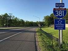
State Route 381 (SR 381) is a primary state highway in the U.S. state of Virginia. Known as Commonwealth Avenue, the state highway runs 1.21 miles (1.95 km) from the Tennessee state line north to the 1.7-mile (2.7 km) Interstate 381 (I-381) within the independent city of Bristol. In conjunction with I-381, SR 381 connects I-81 with downtown Bristol. The state highway also connects the Interstate Highways with U.S. Route 11, US 11W, US 11E, US 19, and US 421; SR 381 runs concurrently with the latter three highways between downtown Bristol and US 11. I-381 is a spur from Interstate 81 that provides access to Bristol. It runs for 1.7 miles (2.7 km) from the intersection of Commonwealth Avenue (State Route 381) and Keys/Church Streets in Bristol at exit 0 north to Interstate 81. The I-81 interchange, the only one on I-381, is signed as left exit 1A (81 north) & 1B (81 south).
Route description
_at_U.S._Route_11_and_U.S._Route_19_(Euclid_Avenue)_in_Bristol%2C_Virginia.jpg)
SR 381 begins at the Tennessee state line at State Street, which follows the Virginia–Tennessee state line as the main street of Bristol, Virginia, to the north and Bristol, Tennessee, to the south and forms the easternmost part of Tennessee State Route 1 west of the intersection. The roadway continues south as US 11E and US 19 following Volunteer Parkway, a major arterial through Bristol, Tennessee, that leads toward Johnson City. SR 381 and the two U.S. Highways head north along Commonwealth Avenue, a four-lane divided highway that intersects Goode Street one block north of the state line; Goode Street carries US 421 and both US 11 Truck and US 19 Truck through the Bristol Commercial Historic District. SR 381, US 11E, US 19, and US 421 meet the southern end of SR 113 at separate intersections: Cumberland Street carries northbound SR 113 east and Sycamore Street carries the westbound direction. The four highways continue north to east–west Euclid Avenue, where US 11E has its northern terminus. Westbound Euclid Avenue heads west carrying northbound US 421 and southbound US 11W toward Kingsport and Gate City. US 19 turns east to join US 11 on eastbound Euclid Avenue. SR 381 continues north along Commonwealth Avenue, paralleling a railroad line through an industrial area to its northern terminus at an intersection with Keys Street.[1][2]
The roadway continues north as I-381, which connects downtown Bristol with I-81, the route to Roanoke and Knoxville. Interstate 381 runs for 1.7 miles (2.7 km) from the intersection of Commonwealth Avenue (State Route 381) and Keys/Church Streets in Bristol at exit 0 north to Interstate 81. The I-81 interchange, the only one on I-381, is signed as left exit 1A (81 north) & 1B (I-81 south).[1][2]
History
The Interstate 381 freeway originally opened to traffic on November 20, 1961, the same time as the part of Interstate 81 that bypasses Bristol to the north.
In its original configuration, the interchange between Interstates 81 and 381 was a single Y interchange, providing access from southbound I-81 to southbound I-381 (via a left exit) and northbound I-381 to northbound I-81. By 1989, ramps were added to make it a full direction T interchange. In 1996, southbound I-81 was moved next to the northbound side, turning the southbound left exit and entrance into right-side ramps.
Junction list
The entire route is in Bristol.
| mi[1] | km | Exit | Destinations | Notes | ||
|---|---|---|---|---|---|---|
| 0.00 | 0.00 | Southern terminus of VA 381; Tennessee state line; southern end of US 11E / US 19 / US 421 overlap | ||||
| 0.07 | 0.11 | Southern end of US 11 Truck overlap | ||||
| 0.23 | 0.37 | Cumberland Street (SR 113 north) | ||||
| 0.58 | 0.93 | northern end of US 11E / US 19 / US 421 / US 11 Truck overlap | ||||
| 1.21 | 1.95 | — | Keys Street, Church Street (I-381 begins / SR 381 ends) | Northern terminus of VA 381; southern terminus of I-381 | ||
| 2.91 | 4.68 | 1A-B | Northbound exit and southbound entrance; signed as left exit 1A (north) & 1B (south); I-81 exit 3; northern terminus; tri-stack interchange. | |||
1.000 mi = 1.609 km; 1.000 km = 0.621 mi
| ||||||
References
- 1 2 3 4 "2017 Traffic Data". Virginia Department of Transportation. 2017. Retrieved July 29, 2017.
- City of Bristol (PDF)
- 1 2 Google (2012-01-13). "Virginia State Route 381" (Map). Google Maps. Google. Retrieved 2012-01-13.
External links
| Wikimedia Commons has media related to Virginia State Route 381. |
- "3-digit Interstates from I-81". kurumi.com.
- Kozel, Scott. "Interstate 381 in Virginia". Roads to the Future.
- "Interstate 381 Virgina". Interstate-Guide.com.
- "Interstate 381 & Virginia 381". AARoads.com.
- Froehlig, Adam; Roberson, Mike. "VA 381 to 400". Virginia Highway Index.