Interlaken, Utah
| Interlaken, Utah | |
|---|---|
| Town | |
| Coordinates: 40°32′28″N 111°28′31″W / 40.54111°N 111.47528°WCoordinates: 40°32′28″N 111°28′31″W / 40.54111°N 111.47528°W | |
| Country | United States |
| State | Utah |
| County | Wasatch |
| Incorporated | May 20, 2015[1] |
| Government | |
| • Mayor | Lisa Simpkins[2] |
| Area | |
| • Total | 0.223 sq mi (0.58 km2) |
| • Land | 0.223 sq mi (0.58 km2) |
| • Water | 0 sq mi (0 km2) |
| Elevation[3] | 5,919 ft (1,805 m) |
| Time zone | UTC-7 (Mountain (MST)) |
| • Summer (DST) | UTC-6 (MDT) |
| ZIP code | 84049 |
| Area code(s) | 435 |
| FIPS code | 49-37924 |
| GNIS feature ID | 2783907[3] |
| Website |
www |
Interlaken is a town in Wasatch County, Utah, United States.[3] The current mayor is Lisa Simpkins[2]
Geography
The entire town is situated on the foothills in northwestern Heber Valley. It is surrounded on three sides (west, north, and east) by the Wasatch Mountain State Park. On the south is the city of Midway, which provides the only access to the town via Interlaken Drive. (Interlake Drive is accessed by way of East 1050 North [Birgi Lane], at about 200 East, in Midway. Despite being nearly surrounded by the Wasatch State Park, there is no direct access between the town and the park.)[4] According to the United States Census Bureau, the town has a total area of 0.223 square miles (0.58 km2), all of it land.[5]
History
The town was officially incorporated on May 20, 2015.[1]
See also
References
- 1 2 "Certification of Incorporation" (PDF). municert.utah.gov. State of Utah. Retrieved 26 Jul 2017.
- 1 2 "From the Interlaken Mayor and Town Clerk" (PDF). docs.wixstatic.com. Town of Interlaken. 12 May 2016. Retrieved 26 Jul 2017.
- 1 2 3 U.S. Geological Survey Geographic Names Information System: Town of Interlaken
- ↑ Google (26 Jul 2017). "Interlaken, Utah" (Map). Google Maps. Google. Retrieved 26 Jul 2017.
- ↑ "2016 U.S. Gazetteer Files". census.gov. United States Census Bureau. Retrieved 15 Jun 2017.
External links
| Wikimedia Commons has media related to Interlaken, Utah. |
Places adjacent to Interlaken, Utah | ||||||||||
|---|---|---|---|---|---|---|---|---|---|---|
| ||||||||||
Municipalities and communities of Wasatch County, Utah, United States | ||
|---|---|---|
| Cities | 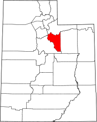 | |
| Towns | ||
| CDP | ||
| Indian reservation | ||
| Ghost towns | ||
| Footnotes | ‡This populated place also has portions in an adjacent county or counties | |