Innoko River
| Innoko River | |
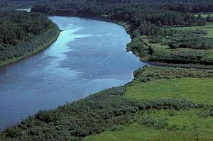 Innoko River in summer | |
| Country | United States |
|---|---|
| State | Alaska |
| Census Area | Yukon–Koyukuk |
| Source | south of Cloudy Mountain |
| - location | Innoko National Wildlife Refuge |
| - elevation | 2,325 ft (709 m) [1] |
| - coordinates | 63°08′55″N 156°01′30″W / 63.14861°N 156.02500°W [2] |
| Mouth | Yukon River |
| - location | 1.5 miles (2.4 km) east of Holy Cross |
| - elevation | 26 ft (8 m) [2] |
| - coordinates | 62°11′45″N 159°43′15″W / 62.19583°N 159.72083°WCoordinates: 62°11′45″N 159°43′15″W / 62.19583°N 159.72083°W [2] |
| Length | 500 mi (805 km) [2] |
 Location of the mouth of the Innoko River in Alaska | |
The Innoko River /ɪˈnoʊkoʊ/ is a 500-mile (800 km) tributary of the Yukon River in the U.S. state of Alaska.[2] It flows north from its origin south of Cloudy Mountain in the Kuskokwim Mountains and then southwest to meet the larger river across from Holy Cross.[3]
Most of its upper portion flows through the Innoko National Wildlife Refuge.[3] The entire river is within the Yukon–Koyukuk Census Area.[2]
Innoko is a Deg Hit’an name for the river.[4] The Russian colonial administrators also called the river Shiltonotno, Legon or Tlegon, Chagelyuk or Shageluk and Ittege at various times in the 19th century.[2]
See also
References
- ↑ Derived by entering source coordinates in Google Earth.
- 1 2 3 4 5 6 7 "Innoko River". Geographic Names Information System. United States Geological Survey. March 31, 1981. Retrieved September 30, 2013.
- 1 2 Alaska Atlas & Gazetteer (7th ed.). Yarmouth, Maine: DeLorme. 2010. pp. 100, 131. ISBN 978-0-89933-289-5.
- ↑ Bright, William (2004). Native American Place Names of the United States. Norman: University of Oklahoma Press. p. 184. ISBN 0-8061-3576-X. Retrieved November 7, 2011.
External links

This article is issued from
Wikipedia.
The text is licensed under Creative Commons - Attribution - Sharealike.
Additional terms may apply for the media files.