Inner Ring Road (Wuhan)
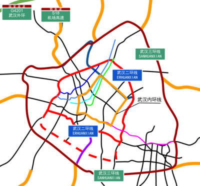
Map of Wuhan with Inner Ring Road in orange.
The Inner Ring Road (Chinese: 武汉内环线; pinyin: Wǔhàn Nèihuánxiàn; literally: "Wuhan Inner Ring Line"), is a 28 km long ring road in Wuhan, China. It consists of a collection of surface arterial roads connecting the busy riverside commercial areas of Wuhan's three main central districts.[1] The ring road was formed when the Second Wuhan Yangtze River Bridge opened, forming a complete loop with the already completed Wuhan Yangtze River Bridge and existing surface streets.
References
- ↑ "武汉规划网-武汉市规划研究院". www.whplan.cn. Retrieved 2017-10-29.
This article is issued from
Wikipedia.
The text is licensed under Creative Commons - Attribution - Sharealike.
Additional terms may apply for the media files.