Inariyama-kōen Station
Inariyama-kōen Station 稲荷山公園駅 | |
|---|---|
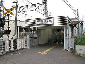 Inariyama-kōen Station south entrance, August 2009 | |
| Location |
1-1 Inariyama, Sayama-shi, Saitama-ken (埼玉県狭山市稲荷山1-1) Japan |
| Operated by |
|
| Line(s) |
|
| Platforms | 2 side platforms |
| Connections |
|
| Other information | |
| Station code | SI22 |
| History | |
| Opened | 1933 |
| Traffic | |
| Passengers (FY2013) | 8,780 daily |
Inariyama-kōen Station (稲荷山公園駅 Inariyama-kōen-eki) is a railway station on the Seibu Ikebukuro Line in Sayama, Saitama, Japan, operated by the private railway operator Seibu Railway.
Lines
Inariyama-kōen Station is served by the Seibu Ikebukuro Line from Ikebukuro in Tokyo, with some services inter-running via the Tokyo Metro Yurakucho Line to Shin-Kiba and the Tokyo Metro Fukutoshin Line to Shibuya and onward via the Tokyu Toyoko Line and Minato Mirai Line to Motomachi-Chukagai. Located between Musashi-Fujisawa and Irumashi, it is 35.9 km from the Ikebukuro terminus.[1]
Station layout
The station consists of two ground-level side platforms serving two tracks,[2] connected to the station building by a footbridge.
Platforms
| 1 | ■ Seibu Ikebukuro Line | for Tokorozawa, Nerima, and Ikebukuro Tokyu Toyoko Line for Yokohama Minatomirai Line for Motomachi-Chukagai |
| 2 | ■ Seibu Ikebukuro Line | for Hannō and Seibu-Chichibu |
Adjacent stations
| « | Service | » | ||
|---|---|---|---|---|
| Seibu Ikebukuro Line | ||||
| Chichibu/Musashi limited express: Does not stop at this station | ||||
| Rapid express: Does not stop at this station | ||||
| Musashi-Fujisawa | Express | Irumashi | ||
| Musashi-Fujisawa | Commuter express | Irumashi | ||
| Musashi-Fujisawa | Rapid | Irumashi | ||
| Musashi-Fujisawa | Commuter semi express | Irumashi | ||
| Musashi-Fujisawa | Semi express | Irumashi | ||
| Musashi-Fujisawa | Local | Irumashi | ||
History
The station opened on 1 April 1933.[1]
Station numbering was introduced on all Seibu Railway lines during fiscal 2012, with Inariyama-kōen Station becoming "SI22".[3]
Through-running to and from Yokohama and Motomachi-Chukagai via the Tokyu Toyoko Line and Minatomirai Line commenced on 16 March 2013.[4]
Passenger statistics
In fiscal 2013, the station was the 68th busiest on the Seibu network with an average of 8,780 passengers daily.[5]
The passenger figures for previous years are as shown below.
| Fiscal year | Daily average |
|---|---|
| 2000 | 10,833[1] |
| 2009 | 8,463[6] |
| 2010 | 8,457[7] |
| 2011 | 8,396[8] |
| 2012 | 8,502[5] |
| 2013 | 8,780[5] |
Surrounding area
North exit
- Iruma Air Base
- Sayama Inariyama Park
- Sayama Hospital
South exit
- Tokyo Kasei University Sayama Campus
- Sainomori Iruma Park
- Sayama Keizai High School
- Iruma Koyo High School
References
- 1 2 3 Terada, Hirokazu (July 2002). データブック日本の私鉄 [Databook: Japan's Private Railways]. Japan: Neko Publishing. p. 201. ISBN 4-87366-874-3.
- ↑ Kawashima, Ryozo (February 2011). 日本の鉄道 中部ライン 全線・全駅・全配線 第11巻 埼玉南部・東京多摩北部 [Railways of Japan - Chubu Line - Lines/Stations/Track plans - Vol 11 Southern Saitama and Northern Tama Tokyo]. Japan: Kodansha. pp. 19–72. ISBN 978-4-06-270071-9.
- ↑ 西武線全駅で駅ナンバリングを導入します [Station numbering to be introduced at all Seibu stations] (PDF). News Release (in Japanese). Japan: Seibu Railway. 23 February 2012. Archived from the original (pdf) on 24 September 2015. Retrieved 22 February 2013.
- ↑ 東急東横線・メトロ副都心線相互直通、16日スタート [Tokyu Toyoko Line and Tokyo Metro Fukutoshin Line inter-running to start on 16 March]. Nikkei.com (in Japanese). Japan: Nikkei Inc. 15 March 2013. Retrieved 2 April 2013.
- 1 2 3 駅別乗降人員 2013(平成25)年度 1日平均 [Average daily station usage figures (fiscal 2013)] (PDF) (in Japanese). Japan: Seibu Railway. Archived from the original (PDF) on 14 July 2014. Retrieved 22 June 2014.
- ↑ 駅別乗降人員 2010(平成22)年度 1日平均 [Average daily station usage figures (fiscal 2010)] (PDF) (in Japanese). Japan: Seibu Railway. Archived from the original (PDF) on 26 June 2011. Retrieved 22 February 2013.
- ↑ 各駅の乗車人員 (2010年度) [Station passenger figures (Fiscal 2010)] (in Japanese). Japan: East Japan Railway Company. Archived from the original on 6 October 2014. Retrieved 22 February 2013.
- ↑ 駅別乗降人員 2011(平成23)年度 1日平均 [Average daily station usage figures (fiscal 2011)] (PDF) (in Japanese). Japan: Seibu Railway. Archived from the original (PDF) on 1 November 2012. Retrieved 22 February 2013.
External links
| Wikimedia Commons has media related to Inariyama-kōen Station. |
- Inariyama-kōen Station information (Seibu Railway) (in Japanese)
Coordinates: 35°50′42″N 139°23′54″E / 35.8451°N 139.3984°E