Ilopango
| Ilopango | |
|---|---|
| Municipality | |
 | |
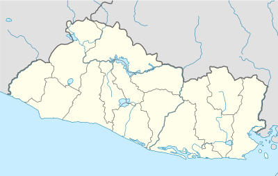 Ilopango Location in El Salvador | |
| Coordinates: 13°42′N 89°07′W / 13.700°N 89.117°W | |
| Country | El Salvador |
| Department | San Salvador Department |
| Government | |
| • Mayor | Salvador Ruano (Nationalist Republican Alliance)[1] |
| Area | |
| • Total | 13.4 sq mi (34.6 km2) |
| Elevation | 1,978 ft (603 m) |
| Population (2009) | |
| • Total | 159,232 |
Ilopango is a town in the San Salvador department of El Salvador. It is a few miles east of the nation's capital, San Salvador. It is located near Lake Ilopango, the country's largest lake at 72 square kilometers.
Overview
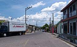
Street in Ilopango
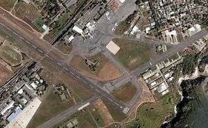
El Salvador's second airport is in Ilopango. It is currently used for charter flights and by the Salvadoran military but plans are underway to increase its use as tourism and travel in El Salvador increase and Comalapa International Airport cannot handle the future influx alone. The Civil Aviation Authority has its headquarters on the airport property,[2] in Ilopango.[3]
References
- ↑ "elsalvador.com, Ediles electos de ARENA no despedirán a empleados". Elsalvador.com. Retrieved 2012-03-17.
- ↑ Home. Civil Aviation Authority. Retrieved on January 5, 2013. "Km 9 1/2 Boulevard del Ejercito Nacional, Aeropuerto Ilopango, El Salvador"
- ↑ "Contactenos." (Archive) Civil Aviation Authority. Retrieved on June 9, 2009. "*Dirección Boulevard del Ejército Km. 9 1/2, contiguo Zona Franca San Bartolo. Ilopango"
External links
![]()
Capital: San Salvador | ||
| Municipalities | 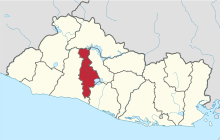 | |
This article is issued from
Wikipedia.
The text is licensed under Creative Commons - Attribution - Sharealike.
Additional terms may apply for the media files.