Illustrated Europe

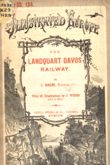
Illustrated Europe no.133-134

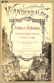
Europäische Wanderbilder no.33
Illustrated Europe was a series of travel guide books to Europe published by Orell Fussli & Co. of Zürich and C. Smith & Son of London.[1] It also appeared in a German-language edition (Europäische Wanderbilder) and a French-language edition (L'Europe illustré).[2] The guides described localities in Austria, Germany, Hungary, Italy, and Switzerland in the 1880s-1890s.
References
- ↑ Catalogue of Maps, Globes, & Diagrams, Published by C. Smith & Son, London, c. 1900
- ↑ "New Geographical Publications", Proceedings of the Royal Geographic Society, London: Royal Geographical Society (12), December 1887
Further reading
- The Arth Rigi Railway, Illustrated Europe (1), Zürich: Orell Füssli & Co., 1884, OCLC 80106306
- Baden-Baden, Illustrated Europe (2)
- Vitznau-Rigi Railway, Illustrated Europe (3)
- Heiden and the Rorschach-Heiden Railway, Illustrated Europe (4)
- Baden in Switzerland, Illustrated Europe (5)
- Thun and the Lake of Thun, Illustrated Europe (6)
- Interlaken, Illustrated Europe (7)
- The Upper Engadine, Illustrated Europe (8)
- Zurich, Illustrated Europe (9)
- Constance, Illustrated Europe (10)
- Nyon on the Lake of Geneva, Illustrated Europe (11)
- Thusis at the Via Mala, Illustrated Europe (12)
- Lucerne, Illustrated Europe (13)
- Florence, Illustrated Europe (14)
- J. Hardmeyer (1884), Milan, Illustrated Europe (15–16)
- Schaffhausen and the Falls of the Rhine, Illustrated Europe (17)
- Ragaz Pfaefers, Illustrated Europe (18)
- Vevey, Illustrated Europe (19)
- Baths of Kreuth, Illustrated Europe (20)
- Davos, Illustrated Europe (21)
- Reinerz, Illustrated Europe (22)
- The Gruyere, Illustrated Europe (23)
- St. Gothard Railway, Illustrated Europe (24–26)
- Freiburg (Baden), Illustrated Europe (27–28)
- Gorbersdorf, Illustrated Europe (29–30)
- Chaux-de-Fonds, Illustrated Europe (31–32)
- From Froburg to Waldenburg, Illustrated Europe (33)
- The Burgenstock (Lake of Lucerne), Illustrated Europe (34–25)
- Neuchatel, Illustrated Europe (36–37)
- Battaglia near Padua, Illustrated Europe (38–39)
- Coire, Illustrated Europe (40–1)
- The Pusterthal Railway, Illustrated Europe (42–44)
- The Brenner Railway, Illustrated Europe (45–47)
- From the Danube to the Adriatic, Illustrated Europe (48–50)
- Graz, Illustrated Europe (51–52)
- From Paris to Berne, Illustrated Europe (53–54)
- The Lake of Lucerne, Illustrated Europe (55–6)
- Jugenheim a Auerbach n. Darmstadt, Illustrated Europe (57)
- Aix-le-Bains, Illustrated Europe (58–9)
- Heidelberg, Illustrated Europe (60–1)
- Budapest, Illustrated Europe (62–64)
- Montreux, Illustrated Europe (65)
- Locarno, Illustrated Europe (66–68)
- Canton Glarus and the Lake of Walenstadt, Illustrated Europe (69–72)
- Mont Cenis, Illustrated Europe (73–76)
- The Black Forest Railway, Illustrated Europe (77–79)
- The Brunig Railway, Illustrated Europe (80–81)
- From the Furka to Brieg, Illustrated Europe (82–3)
- Zurich and its Environs, Illustrated Europe (84–86)
- Brieg and the Simplon, Illustrated Europe (87–8)
- Zermatt and the Valleys of Visp, Illustrated Europe (89–92)
- The Valley of Lotschen and the Baths of Leuk, Illustrated Europe (93–95)
- The Valleys of Turtman and Eifisch, Illustrated Europe (96–98)
- Kurhaus Tarasp, Illustrated Europe (99–100)
- Morat, Illustrated Europe (101–102)
- Sion and its Environs, Illustrated Europe (103–105)
- Martigny and the Valleys of the Dranse, Illustrated Europe (106–109)
- Chamounix and Mont Blanc, Illustrated Europe (110–111)
- From St. Maurice to the Lake of Geneva, Illustrated Europe (112–113)
- Mount Pilatus Railway, Illustrated Europe (114–15)
- Territet, on the Lake of Geneva, Illustrated Europe (116)
- The Hungarian Eastern Carpathians, Illustrated Europe (117)
- From Vienna to Budapest, Illustrated Europe (118–119)
- From Oderburg to Budapest, Illustrated Europe (120)
- From Vienna, Oderburg and Buda-Pesth to the High Tatra, Illustrated Europe (121–123)
- Through West Hungary, Illustrated Europe (124)
- From the Danube to the Quarnero, Illustrated Europe (125–126), OCLC 82183394
- Through the Hungarian Plain, Illustrated Europe (127)
- The Monte Generoso Railway, Illustrated Europe (128)
- The Transylvania Highlands, Illustrated Europe (129–130)
- Through South Hungary, Illustrated Europe (131–132)
- J. Hauri (1893), Landquart-Davos Railway, Illustrated Europe (133–134), OCLC 457706313
- The Kuranstalt Holsboer, Illustrated Europe (135)
- Nervi and its Environs, Illustrated Europe (136–138)
- The Vosges Mountains, Illustrated Europe (139–142)
- Kursaal Maloja, Illustrated Europe (143–4)
- Franzensbad, Illustrated Europe (145–147)
- Spa, Illustrated Europe (148–150)
- Spiez and the Kanderthal, Illustrated Europe (151–2)
- Hohwald and its Environs, Illustrated Europe (153–4)
- Through the Bernese Oberland, Illustrated Europe (155–158)
- Carlsbad, Illustrated Europe (159–161)
- The Toggenburg and Wyl, Illustrated Europe (162–163)
- The Stanserhorn Railway, Illustrated Europe (164)
- Waldhaus-Flims, Illustrated Europe (165)
- Ospedaietti near San Remo, Illustrated Europe (166)
- The Hungarian System of the Royal and Impl. South Railway Co., Illustrated Europe (167), OCLC 55113191
- The Baths of San Moritz, Illustrated Europe (168–9)
- The Baths of Bex, Illustrated Europe (170)
- Meiringen, Illustrated Europe (171–172)
- Soleure and Basle, Illustrated Europe (173)
- Grand Hotel Curhaus Davos, Curanstalt Halsboer, Davos, Illustrated Europe (174), 1899, OCLC 313584740
- Health Resort of Burgenstock, Illustrated Europe (175), 1900
- Pontresina, Illustrated Europe (176)
This article is issued from
Wikipedia.
The text is licensed under Creative Commons - Attribution - Sharealike.
Additional terms may apply for the media files.