Ifo
| Ifo | |
|---|---|
| LGA | |
 Ifo Location in Nigeria | |
| Coordinates: 6°49′N 3°12′E / 6.817°N 3.200°ECoordinates: 6°49′N 3°12′E / 6.817°N 3.200°E | |
| Country |
|
| State | Ogun State |
| Government | |
| • Local Government Chairman and the Head of the Local Government Council | Bello Akeem Olanrewaju[1] |
| Area | |
| • Total | 521 km2 (201 sq mi) |
| Population (2006 census) | |
| • Total | 524,837 |
| Time zone | UTC+1 (WAT) |
| 3-digit postal code prefix | 112 |
| ISO 3166 code | NG.OG.IF |
Ifo is a Local Government Area in Ogun State, Nigeria. Its headquarters are in the town of Ifo at6°49′00″N 3°12′00″E / 6.81667°N 3.20000°E.
It has an area of 521 km² and a population of 524,837 at the 2006 census.
The postal code of the area is 112.[2]
References
- ↑ http://ogunstate.gov.ng/administration/
- ↑ "Post Offices- with map of LGA". NIPOST. Archived from the original on 2009-10-07. Retrieved 2009-10-20.
State capital: Abeokuta | ||
| Local Government Areas | 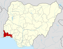 | |
This article is issued from
Wikipedia.
The text is licensed under Creative Commons - Attribution - Sharealike.
Additional terms may apply for the media files.