Huzzah, Missouri
| Huzzah, Missouri | |
|---|---|
| Unincorporated community | |
 Huzzah Location in the state of Missouri | |
| Coordinates: 37°54′16″N 91°09′28″W / 37.90444°N 91.15778°WCoordinates: 37°54′16″N 91°09′28″W / 37.90444°N 91.15778°W[1] | |
| Country | U. S. A. |
| State | Missouri |
| County | Crawford County |
| Elevation[1] | 227 m (745 ft) |
| Time zone | UTC-6 (CST) |
| • Summer (DST) | UTC-5 (CDT) |
Huzzah is an unincorporated community in eastern Crawford County, Missouri, United States. It is located 11.6 miles (18.7 km) southeast of Steelville in the Mark Twain National Forest.[1][2]
A post office called Huzzah was established in 1898, and remained in operation until 1967.[3] The community takes its name from nearby Huzzah Creek.[4]
References
- 1 2 3 Huzzah, Missouri, 7.5 Minute Topographic Quadrangle, USGS 1999
- ↑ Rolla, Missouri, 30x60 Minute Topographic Quadrangle, USGS, 1986
- ↑ "Post Offices". Jim Forte Postal History. Retrieved 25 September 2016.
- ↑ "Crawford County Place Names, 1928–1945 (archived)". The State Historical Society of Missouri. Archived from the original on 24 June 2016. Retrieved 25 September 2016.
Municipalities and communities of Crawford County, Missouri, United States | ||
|---|---|---|
| Cities | 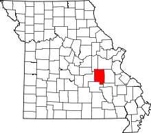 | |
| Villages | ||
| Townships | ||
| Unincorporated communities | ||
| Ghost towns | ||
| Footnotes | ‡This populated place also has portions in an adjacent county or counties | |
This article is issued from
Wikipedia.
The text is licensed under Creative Commons - Attribution - Sharealike.
Additional terms may apply for the media files.